Oddessey
<> MyWalling
<> YON's Historical Maps of Sudbury
<> More Sudbury Maps
<> jch.com
<> YON
Sudbury from Henry F. Walling's Map of Middlesex County, 1856
Henry F. Walling's Map of Middlesex County, 1856. This is a 5x5 foot map assembled from 4 quarters printed separately and assembled. This has great detail, but Sudbury is right in the middle and therefore has 4 different maps that never meet properly, althoe the BPL version seems best. There are TWO links: My Oddessey leading to the creation of the 2012 Walling1856Sudbury.jpg image.
Henry F. Walling and the Mapping of New England’s Towns, 1849–1857
By Michael Buehler (PDF)
from The Journal of the Washington Map Society, Issue 71 Spring 2008
"Henry Walling (1825–1888) was arguably the most accomplished..."
Copies of the Map I know about
And the date I photgraphed them. More details on the Oddessey page.
| |
|
|
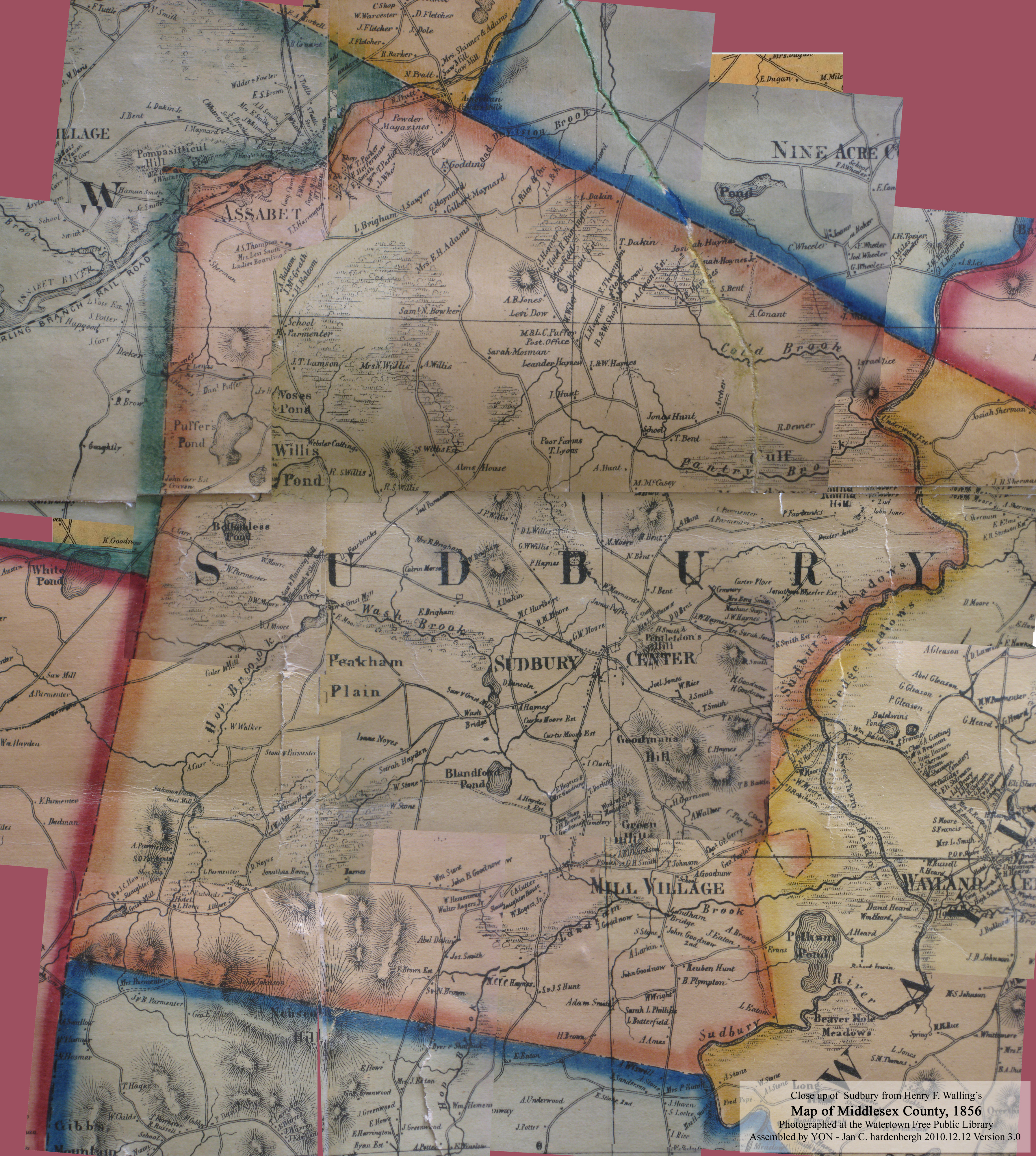
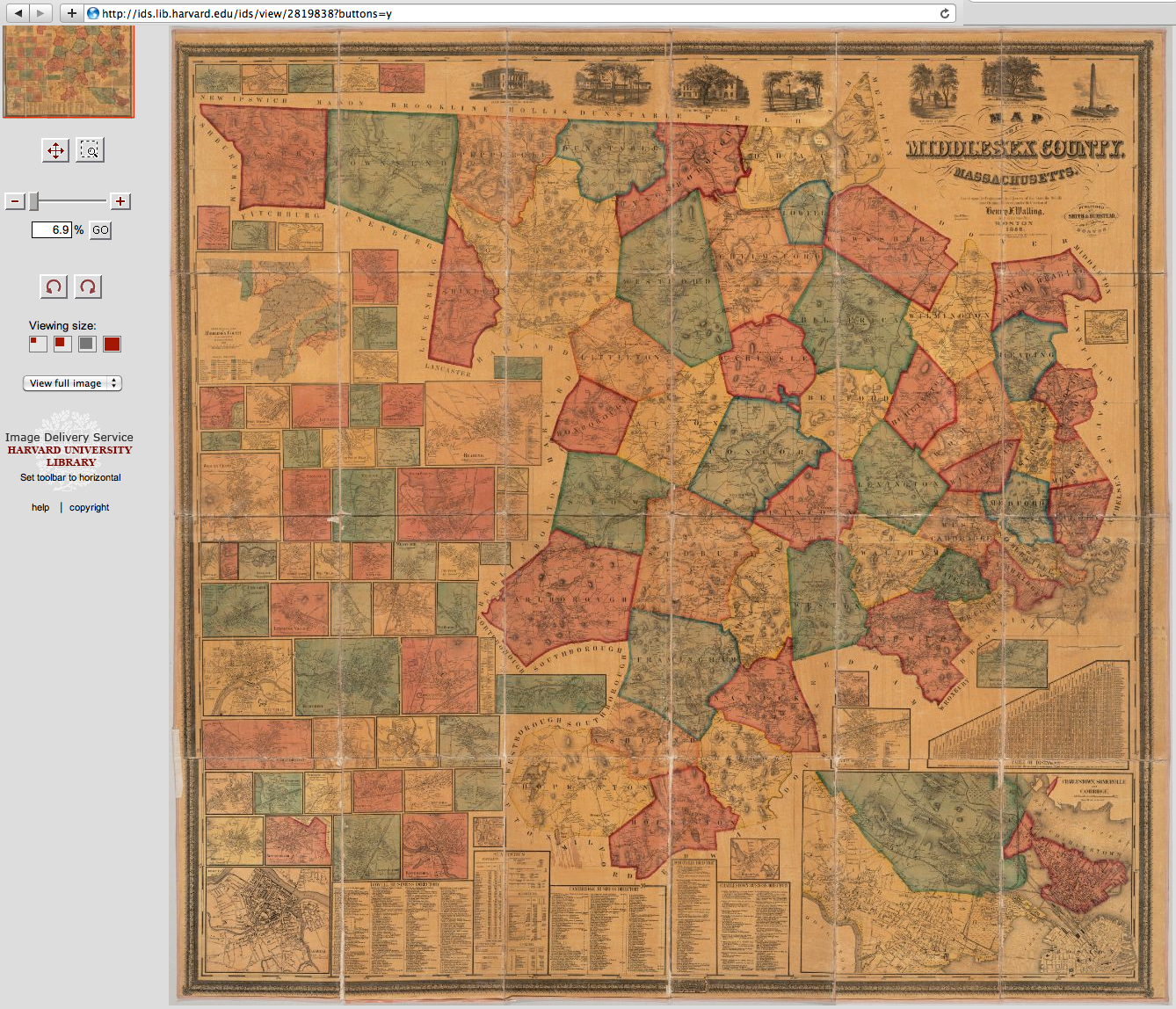
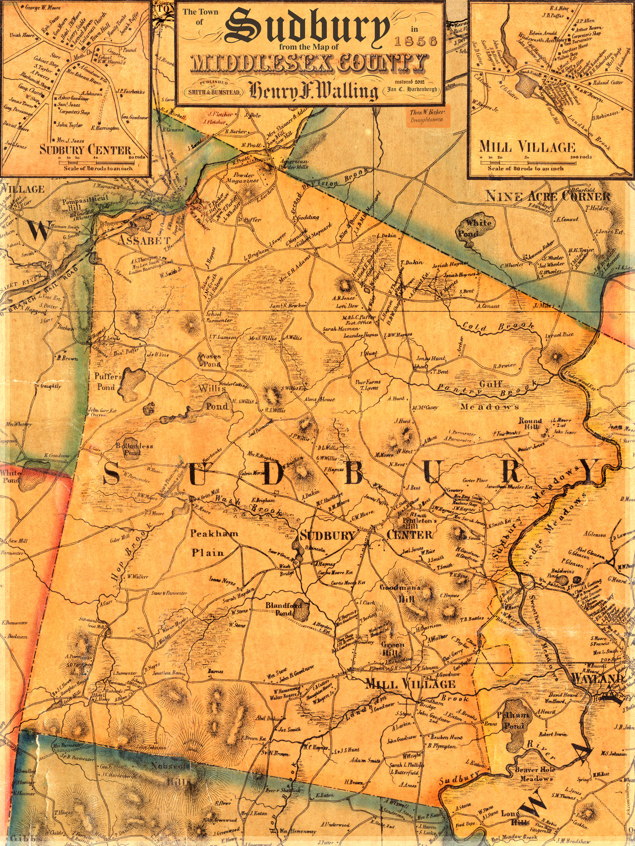
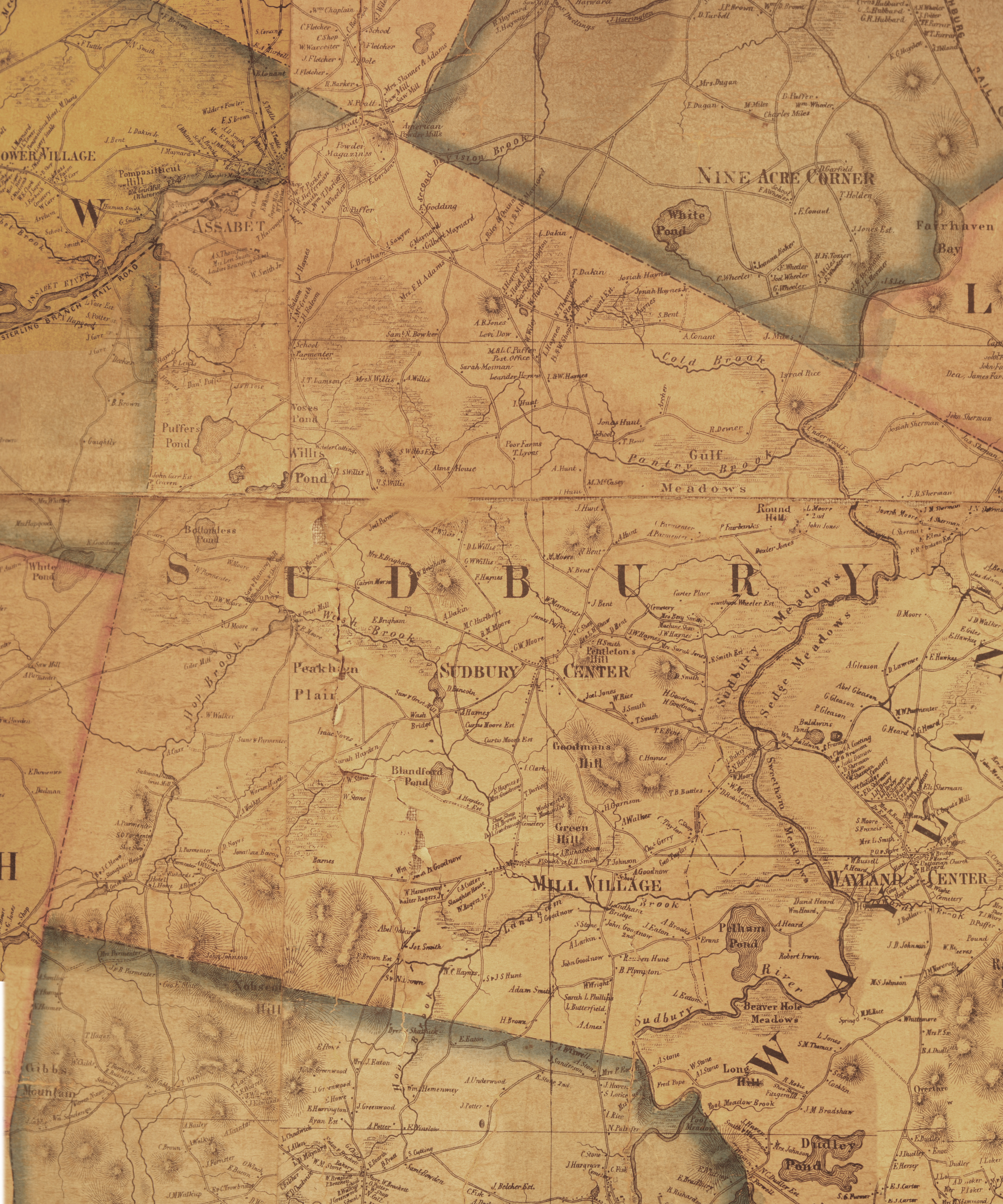
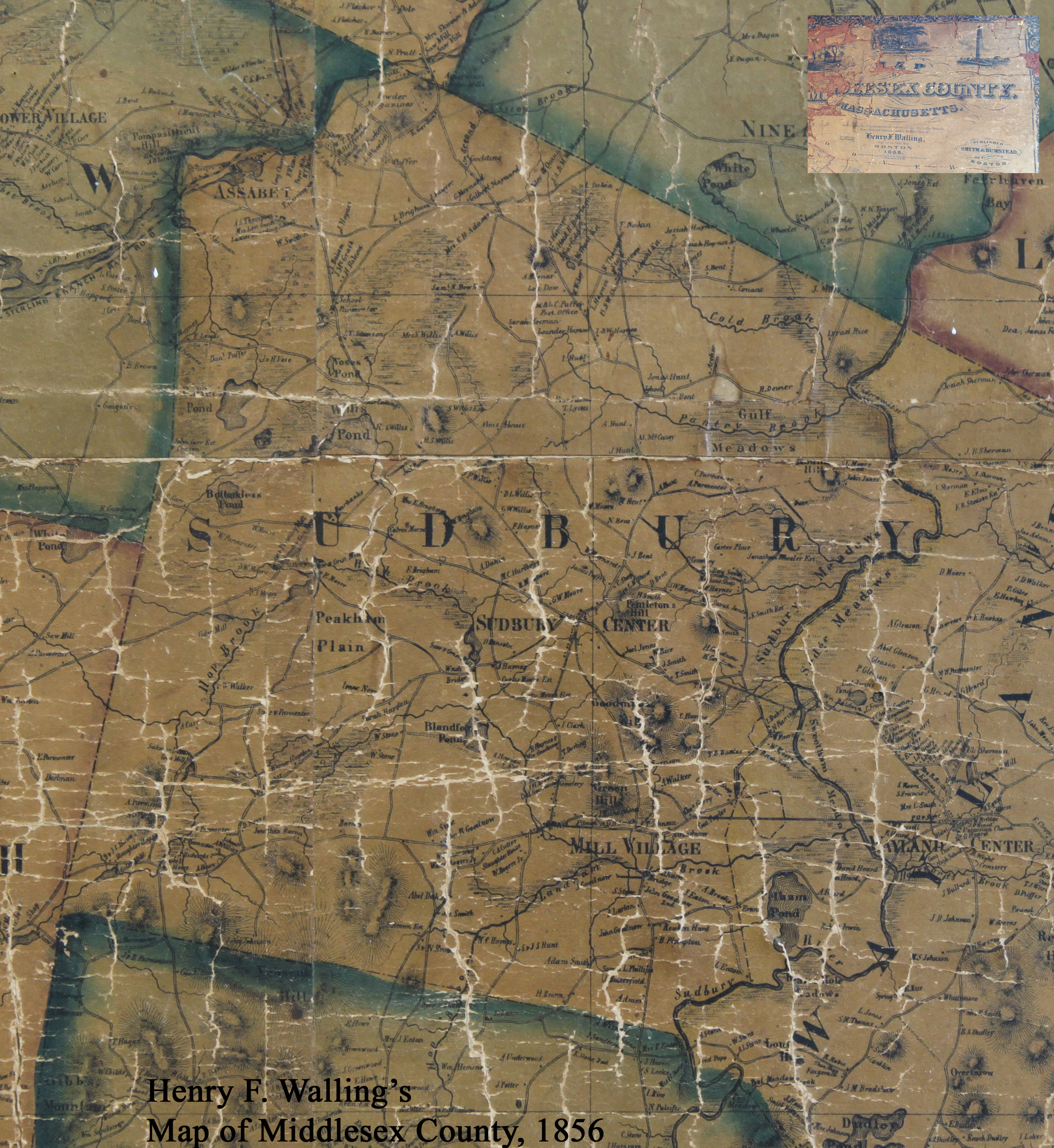
Walling 1856 at Sudbury Town Hall photographed July 2011 |
|
|
Lots of pieces of the map from old-maps.com.
page created to link to Oddessey & My Walling 2012.01.17 YON Jan C. Hardenbergh