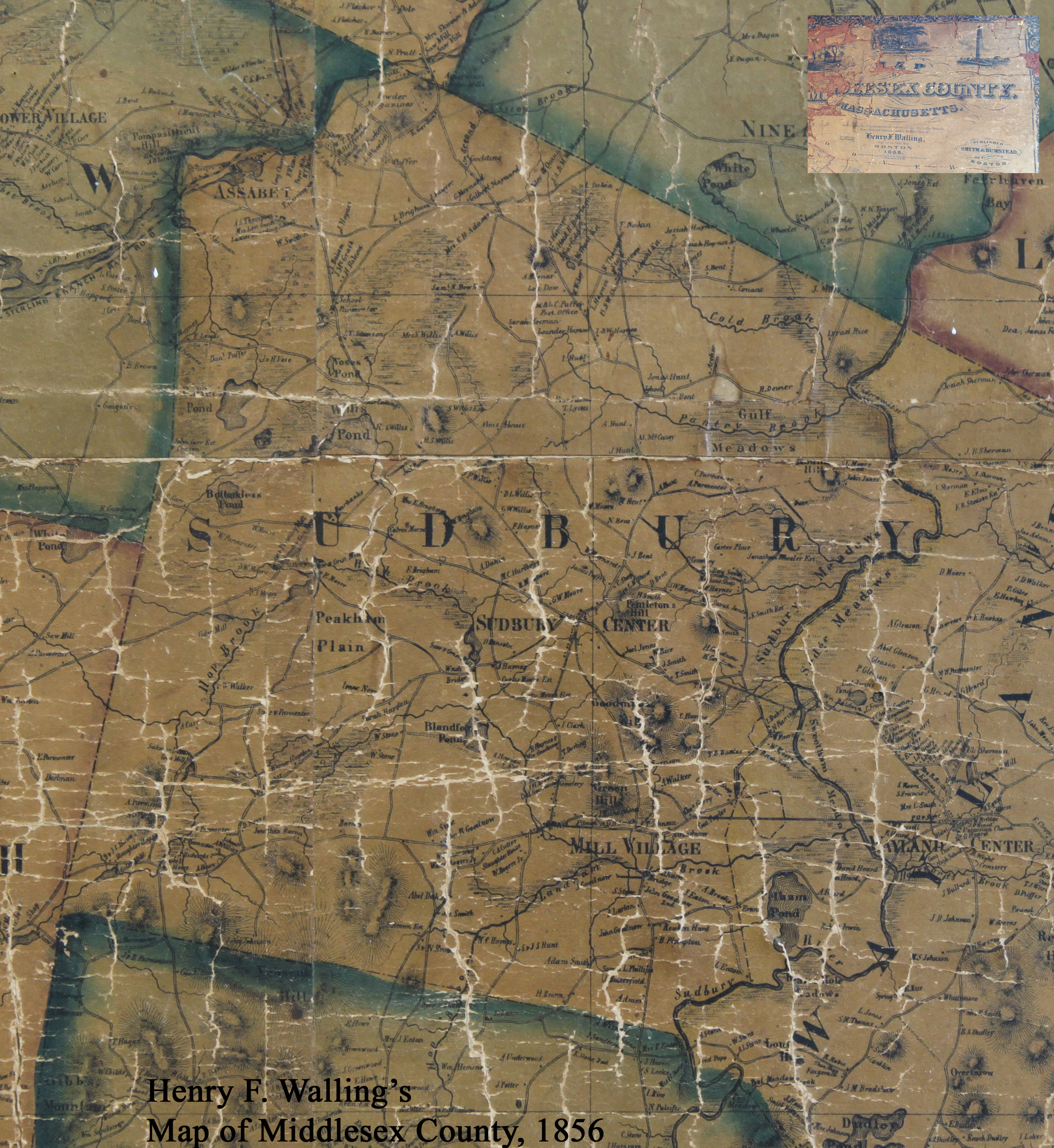
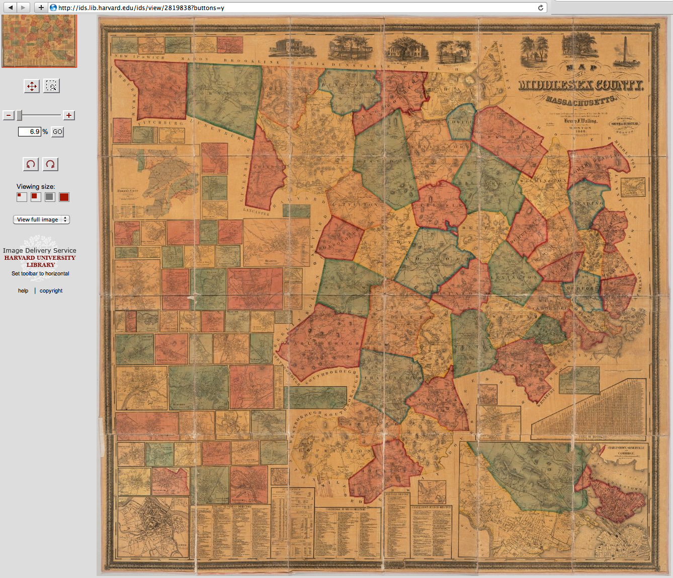
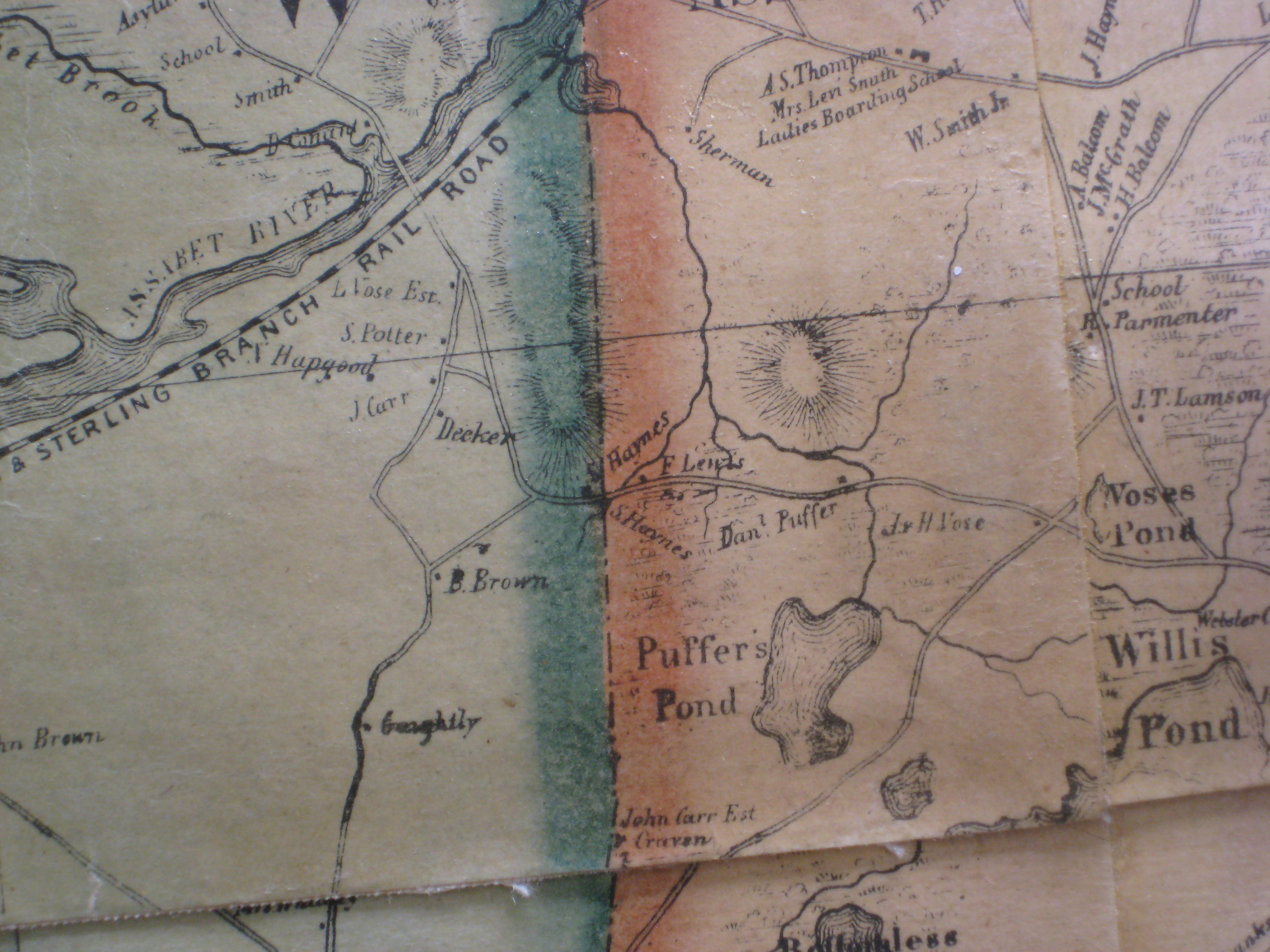
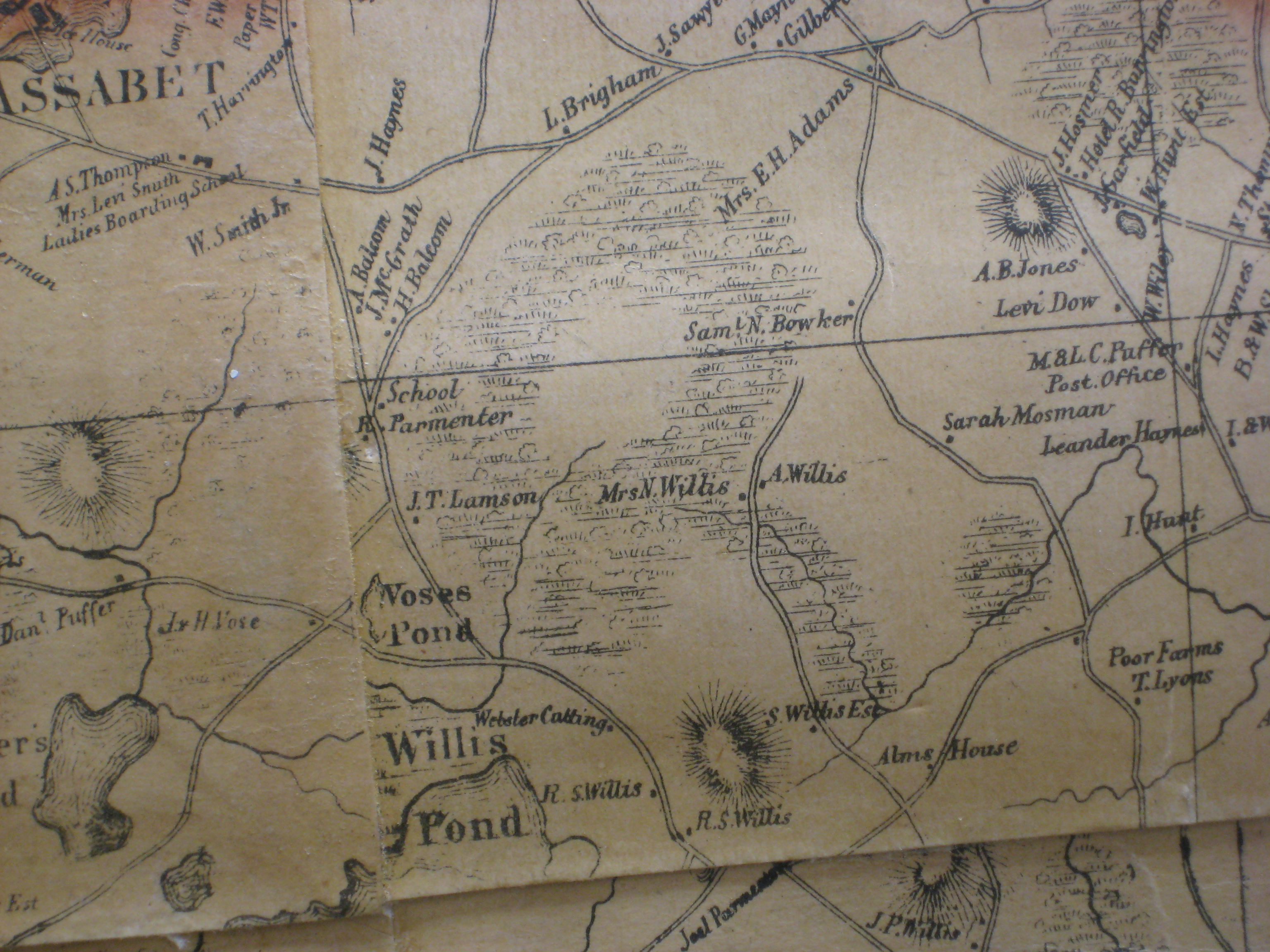
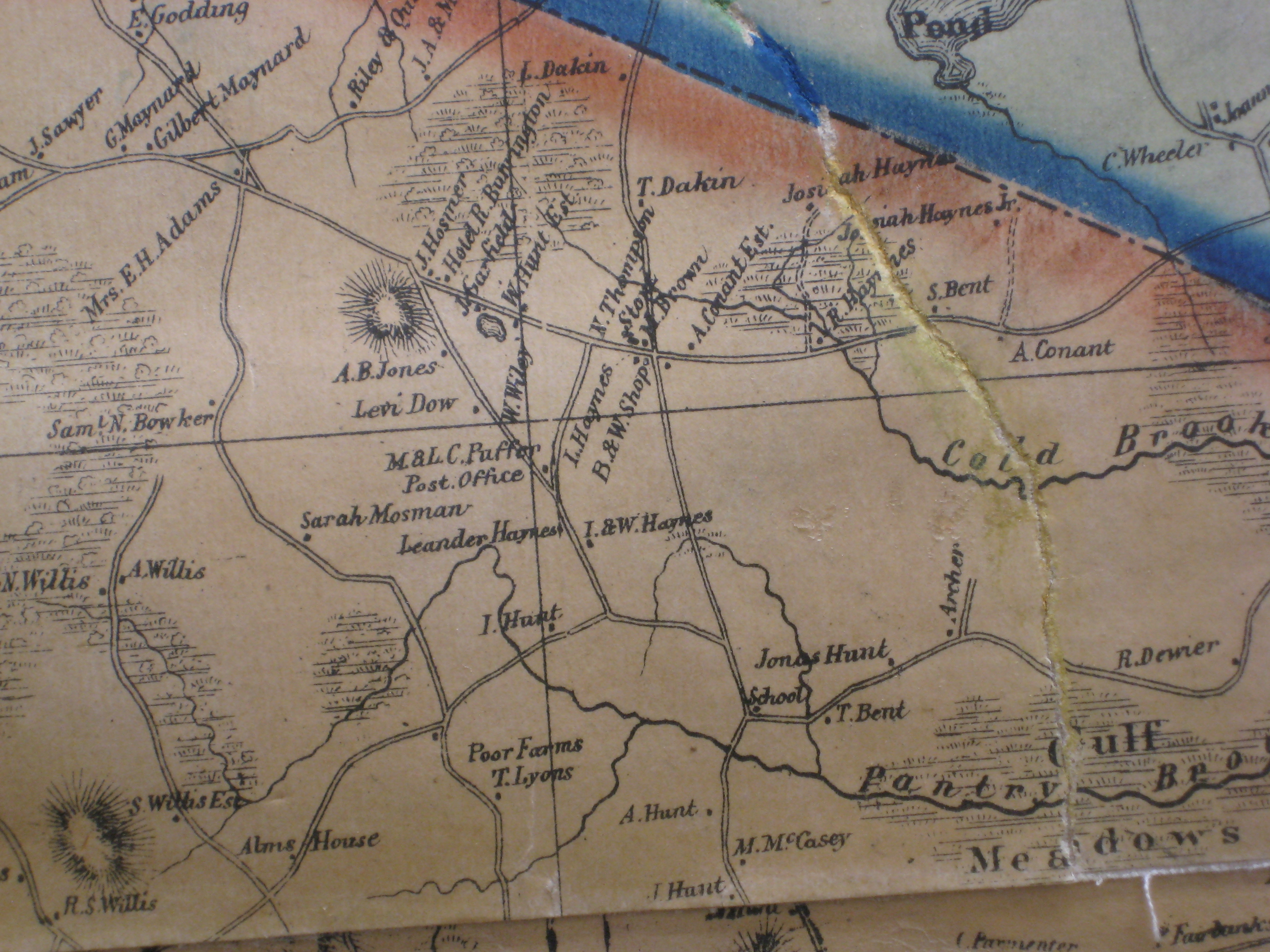
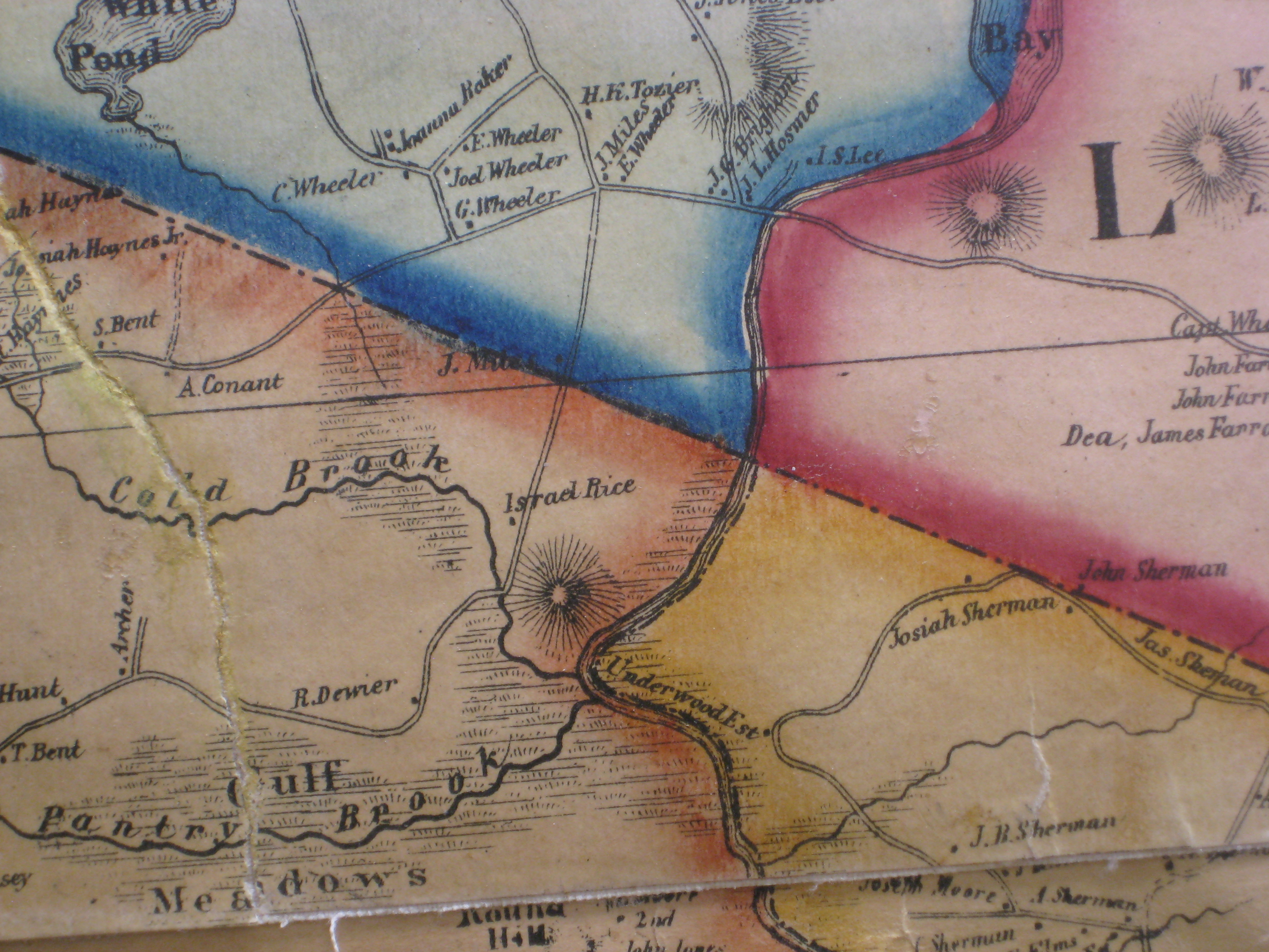
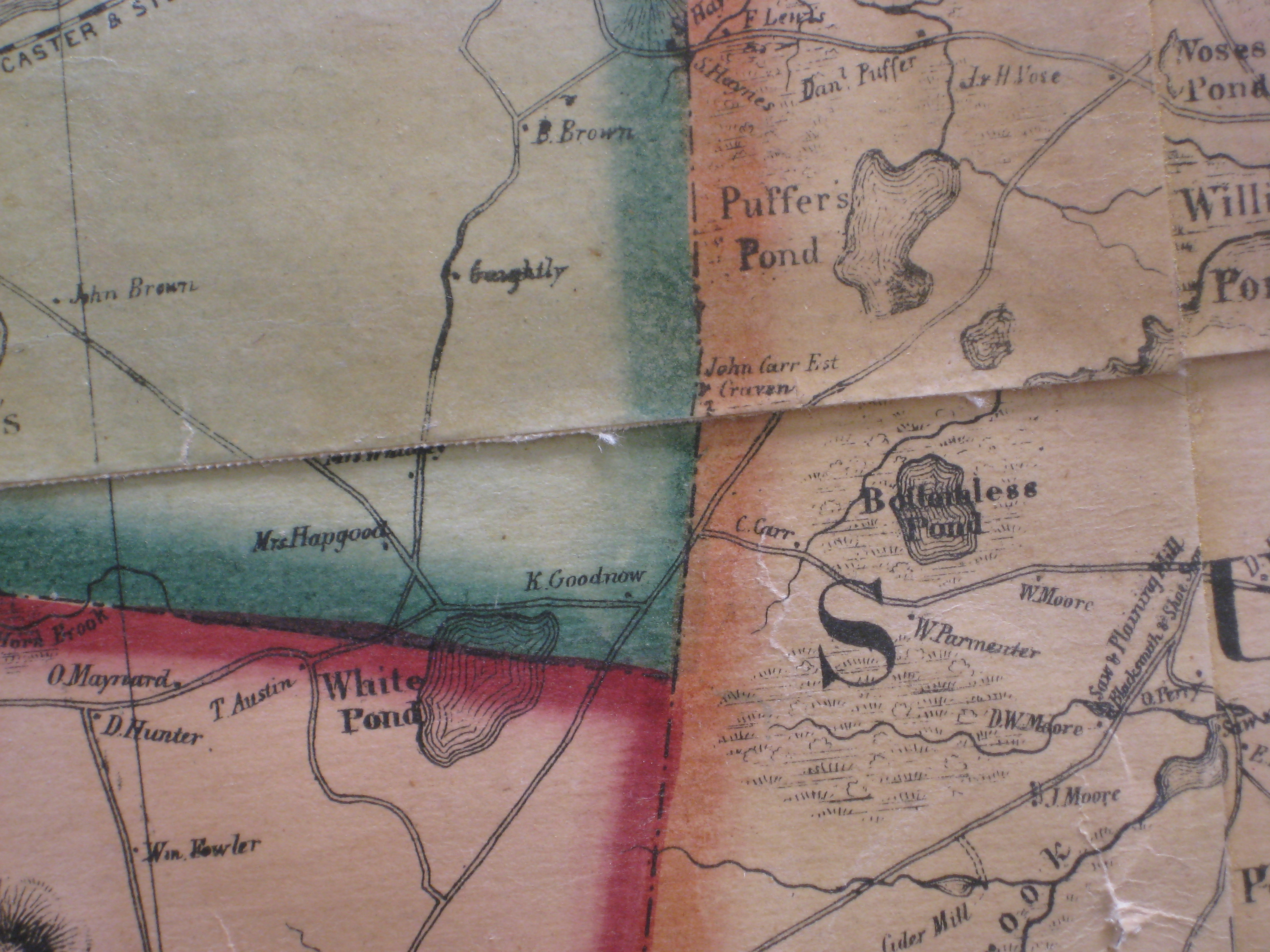
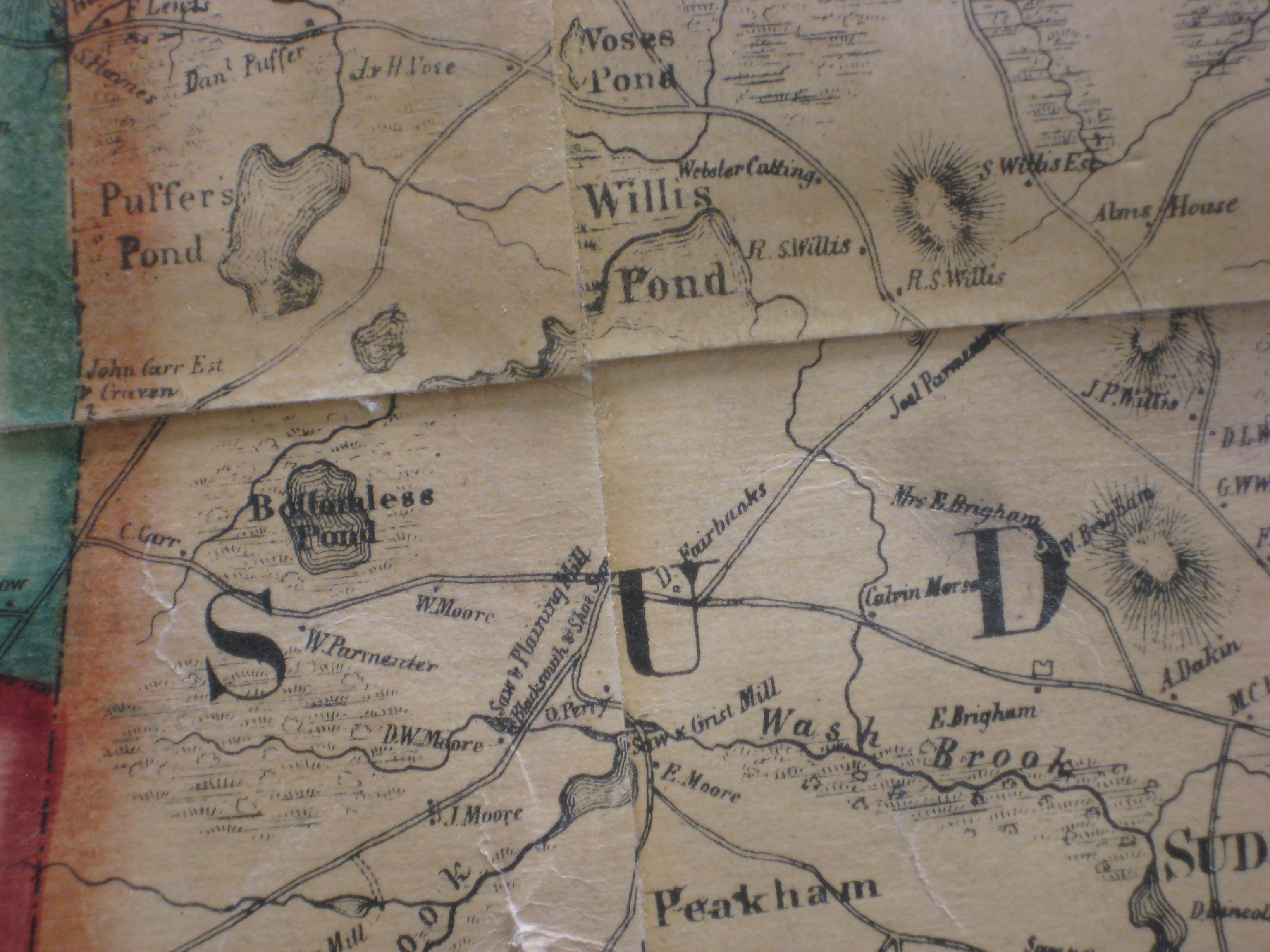
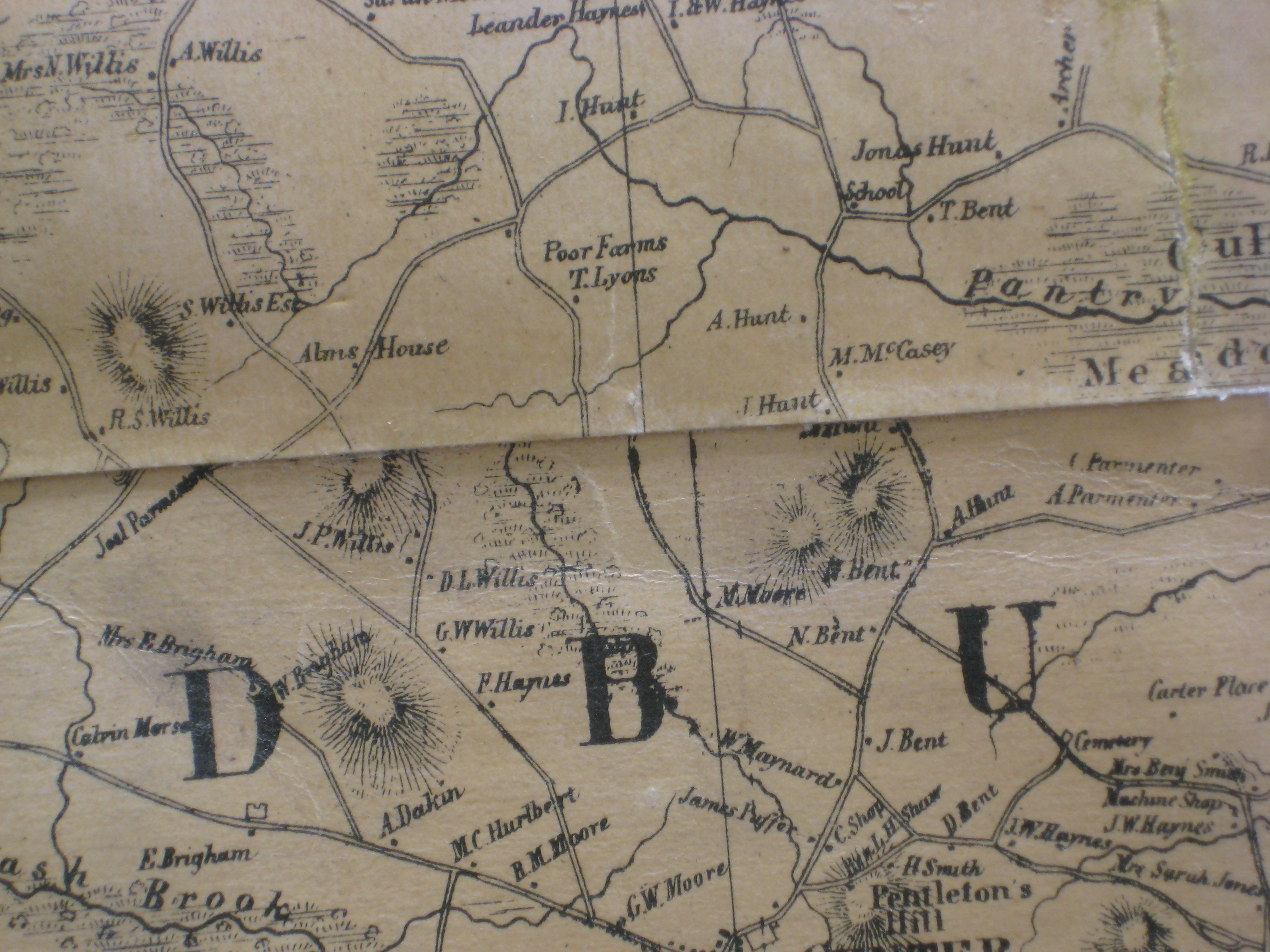
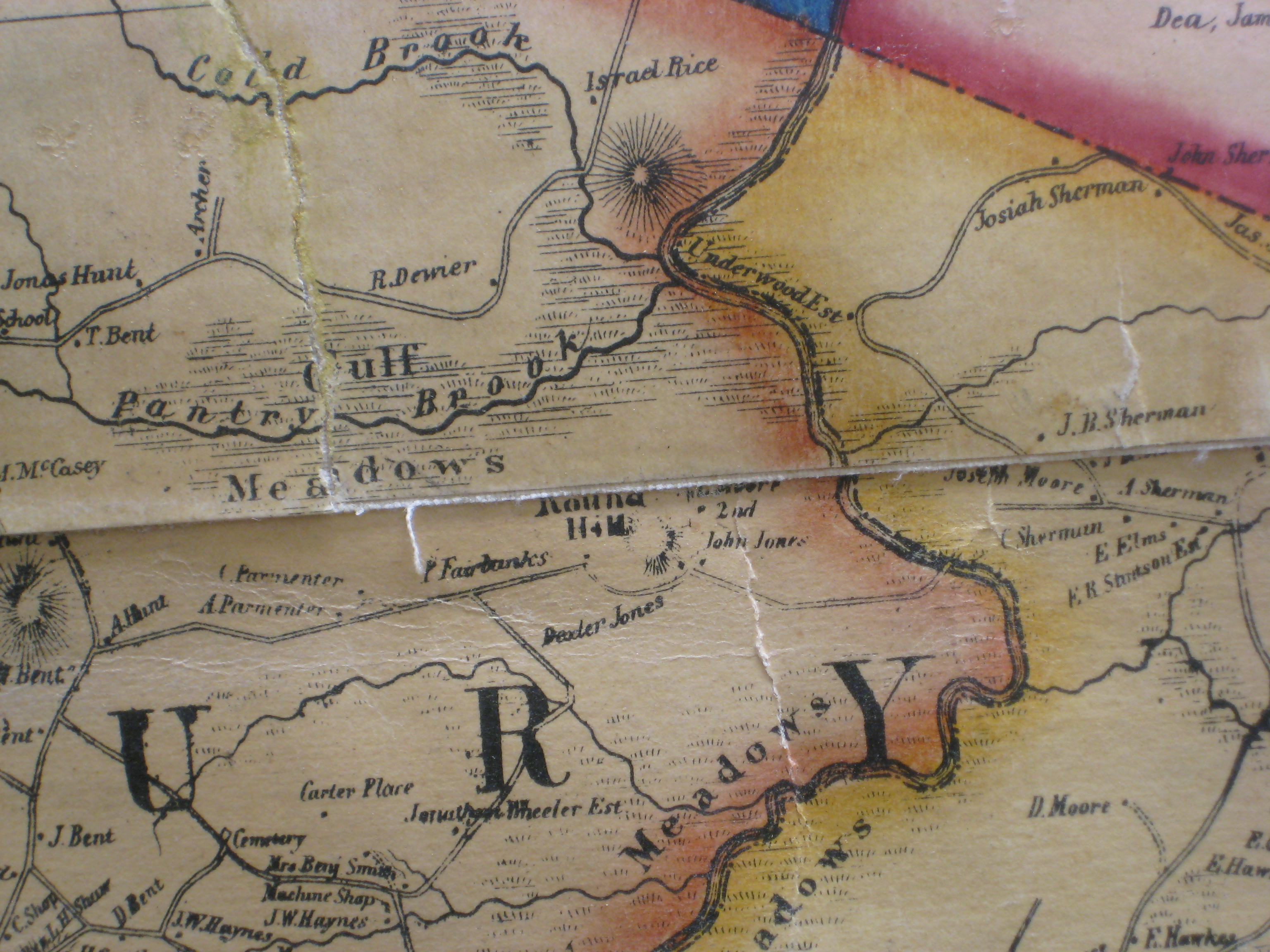
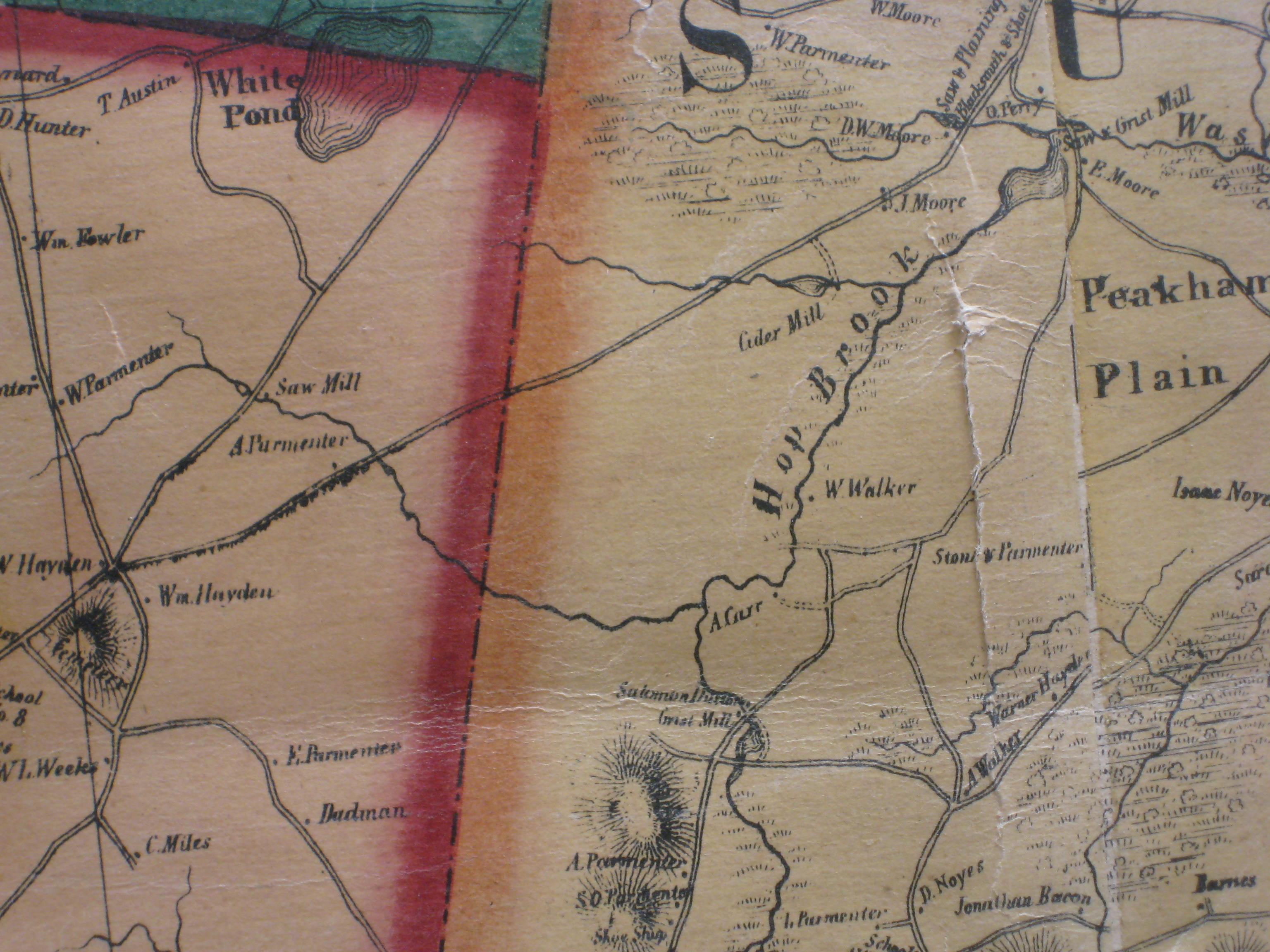
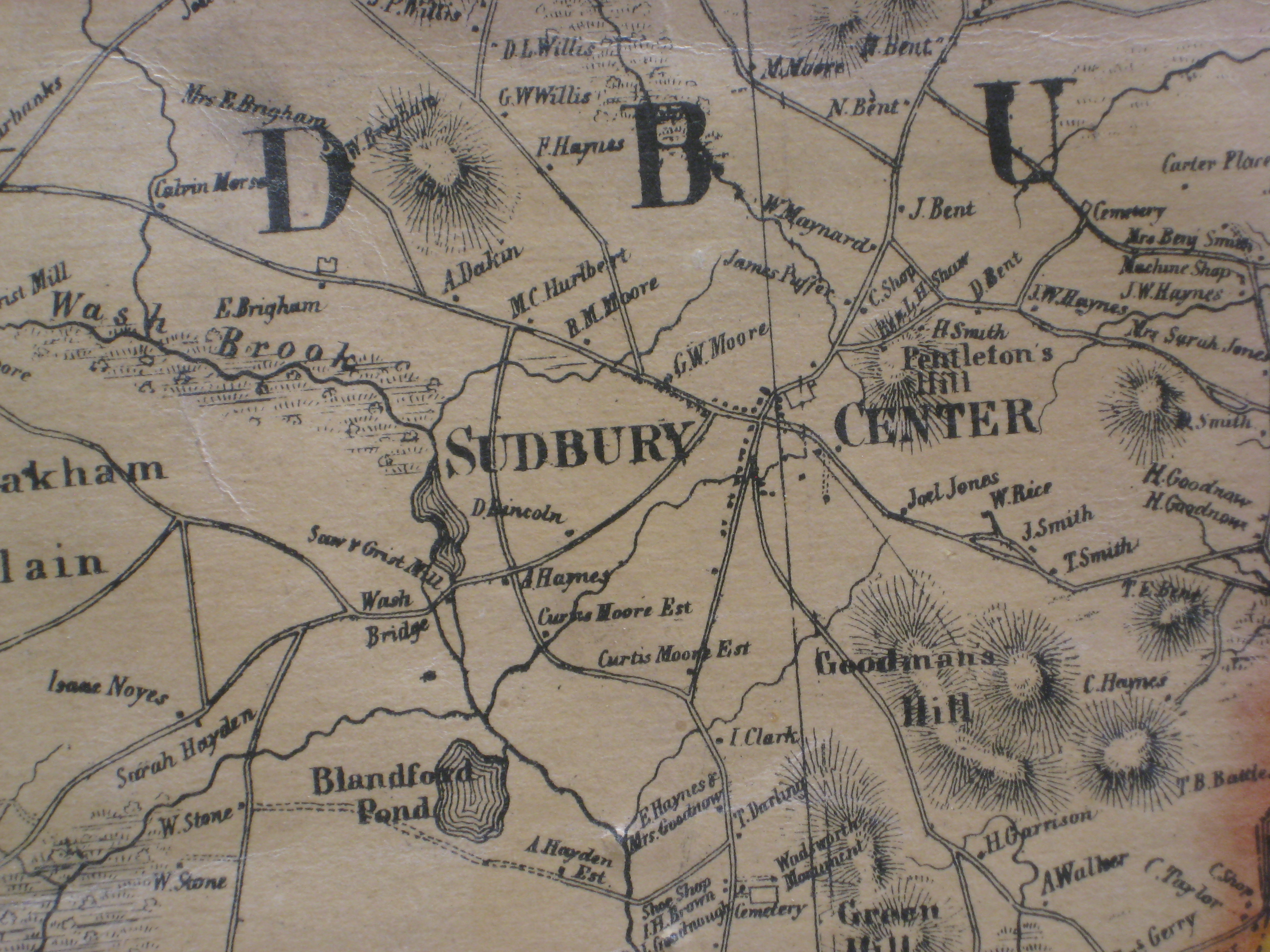
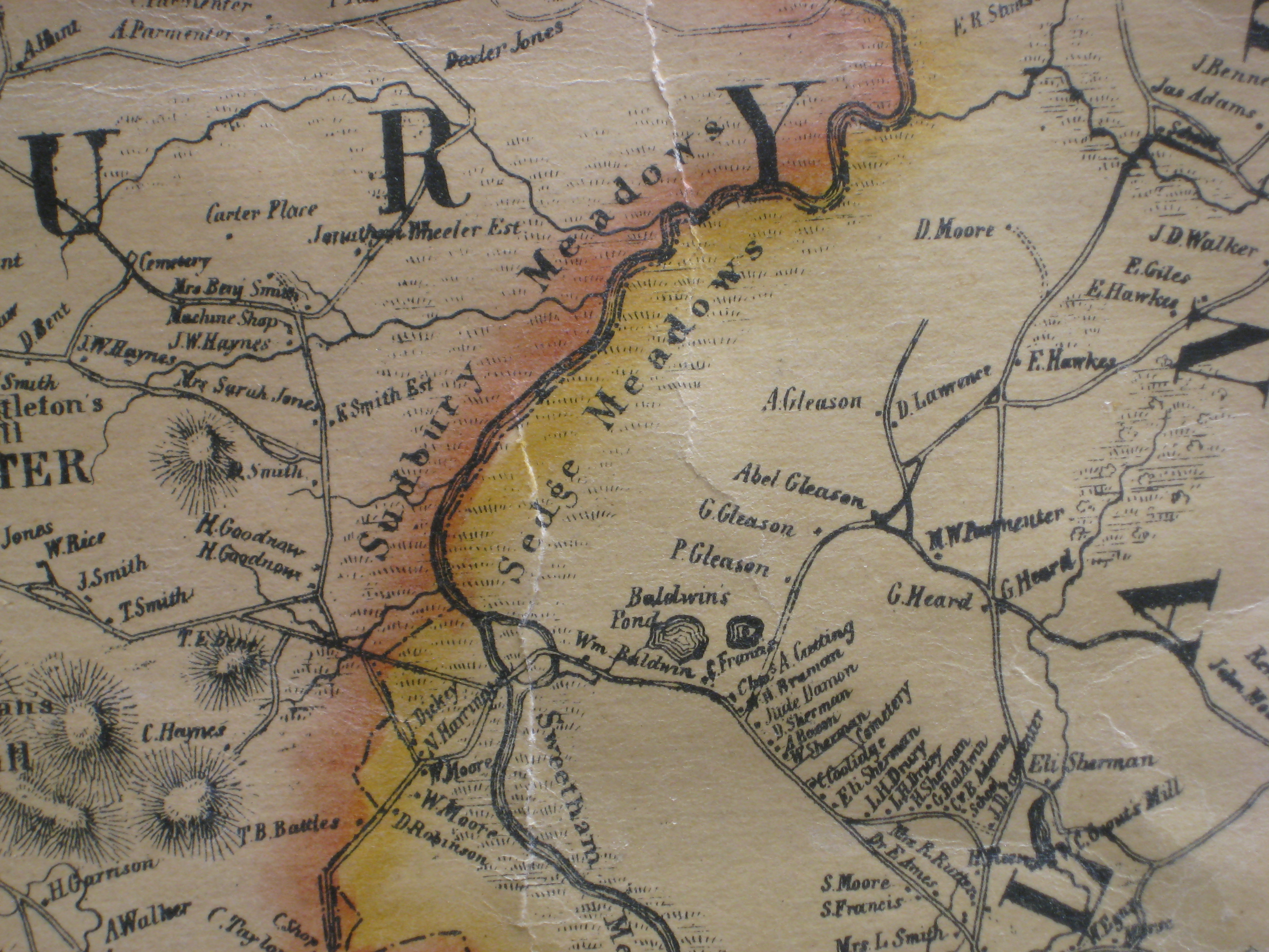
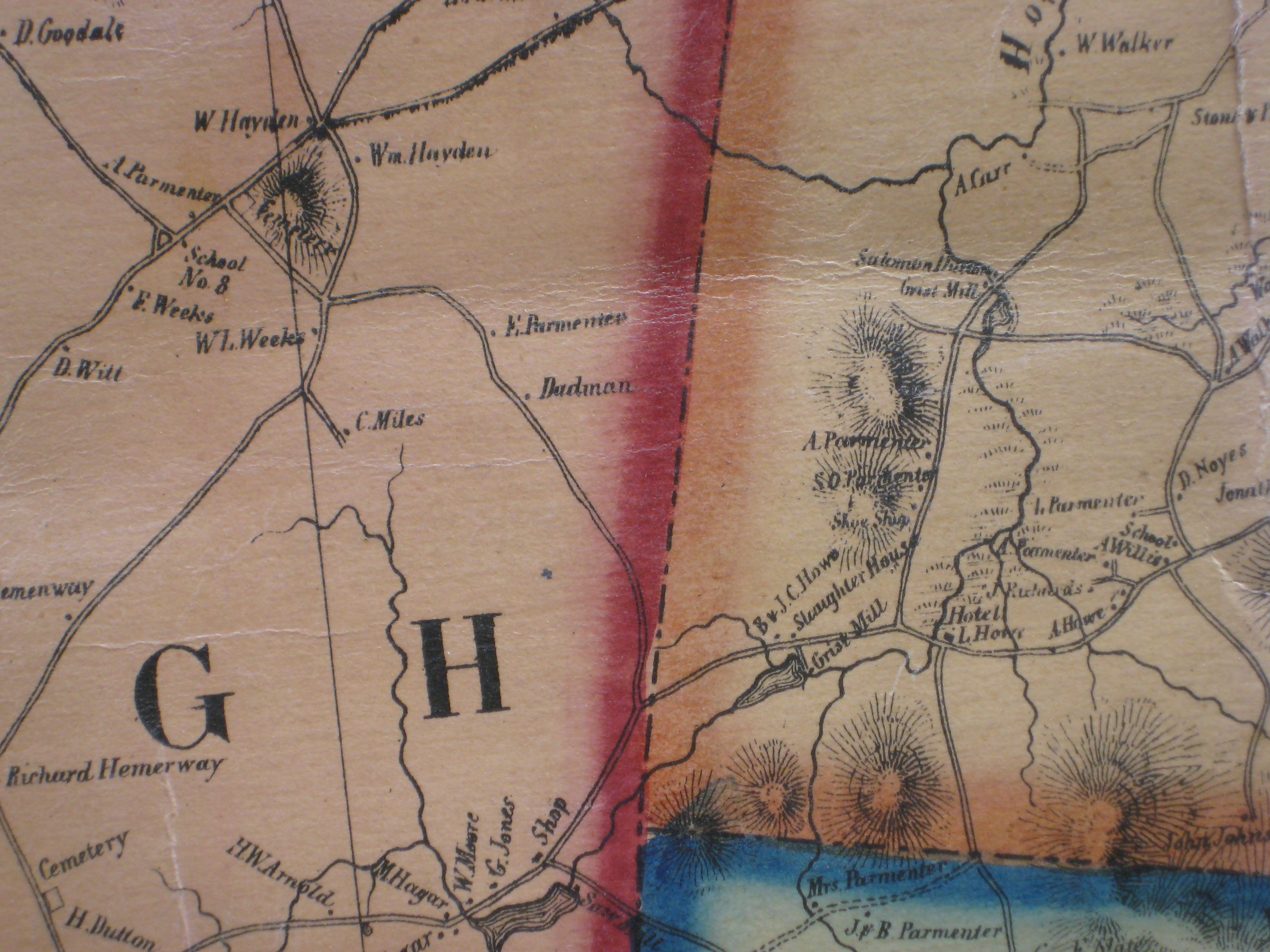
Since there are very few maps of Sudbury (because it was a farming town?) I believe this is the first map after the State mandated 1830 maps (Wood). The version at the Harvard Map Collection (see below) was folded down the middle, so, a wide swath of Sudbury is gone.
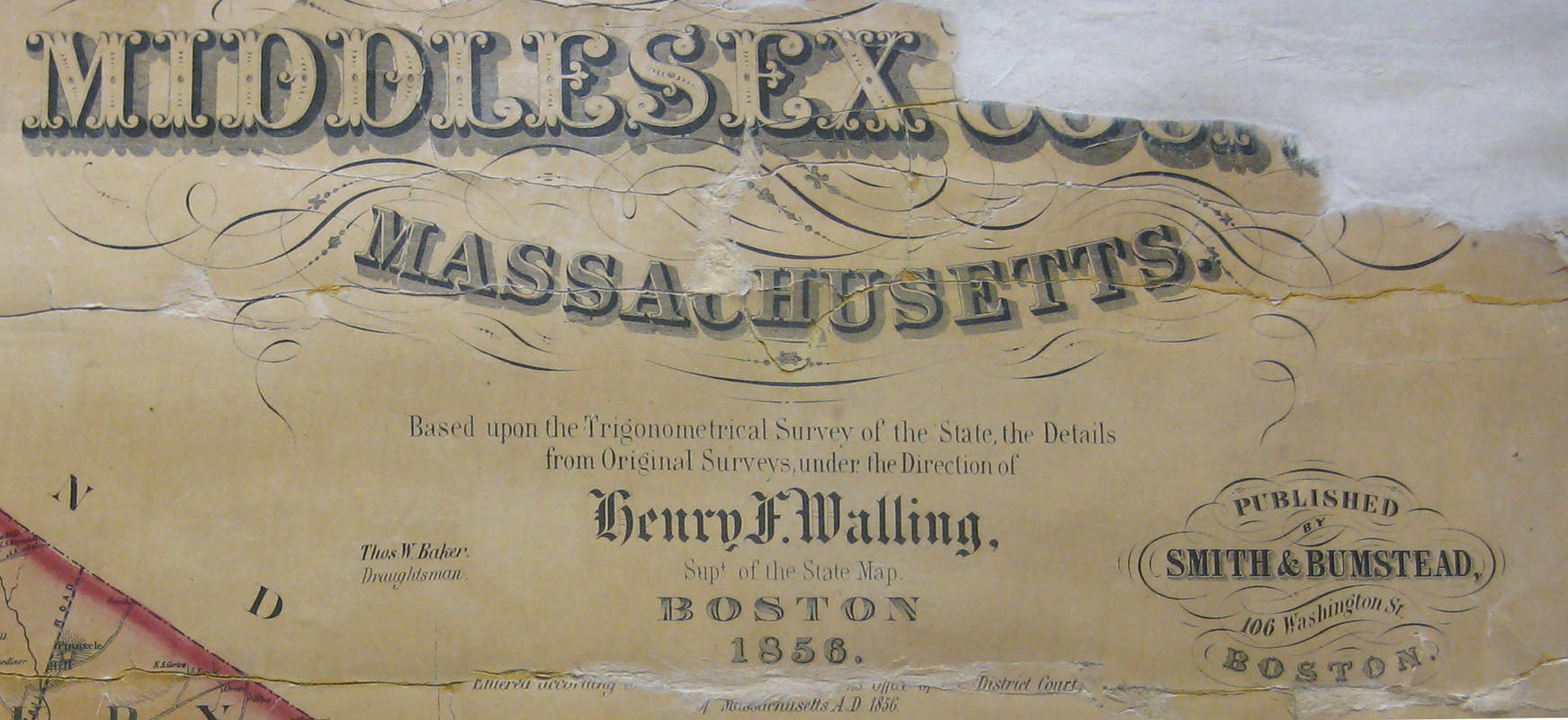
Henry F. Walling and the Mapping of New England’s Towns, 1849–1857
By Michael Buehler (PDF)
from The Journal of the Washington Map Society, Issue 71 Spring 2008
"Henry Walling (1825–1888) was arguably the most accomplished..."
The reproduction I have is from the Havard scan. Unfortunately, Sudbury is right in the middle, so, any folded versions are missing a good chunk of Sudbury. Same with the BPL version. And the original sheets meet in Sudbury, too. In addition to the Harvard & BPL versions, I have seen one for sale by a dealer that did not have good detail of Sudbury. I have photographed the one at the Watertown Free Library - rolled with laquer - Sudbury not too bad. There is a mounted version in the Sudbury Town Hall that is in poor condition and the copy in the Goodnow Library is in fair condition. I have also determined that I will never get a satisfactory result by photographing - at least not without a significant improvement in equipment and methodology. I was quite careful at Goodnow, but...
So, I drove out to Boylston MA on December 18th, 2011, and the Sudbury portion of the map was in good condition. The map over all is in good condition - with a bit of water damage at the top. Photo attached. So, I bought it, moving me from hobbyist to investor. Sort of. My primary goal is to get a clean hi-res scan of Sudbury. I am hoping to sell it at some point in the future.
 In November of 2011, I photographied the Sudbury section of the Walling Map at the Goodnow Library. I came to the conclusion that I will never get what I want from photographs.
sigh... Thank you to Esmé and the Trustees for the permissions to photograph.
While poking around I found the BPL has a good scan: http://maps.bpl.org/details_12690
Still, Sudbury is right in the middle, so, a large portion missing.
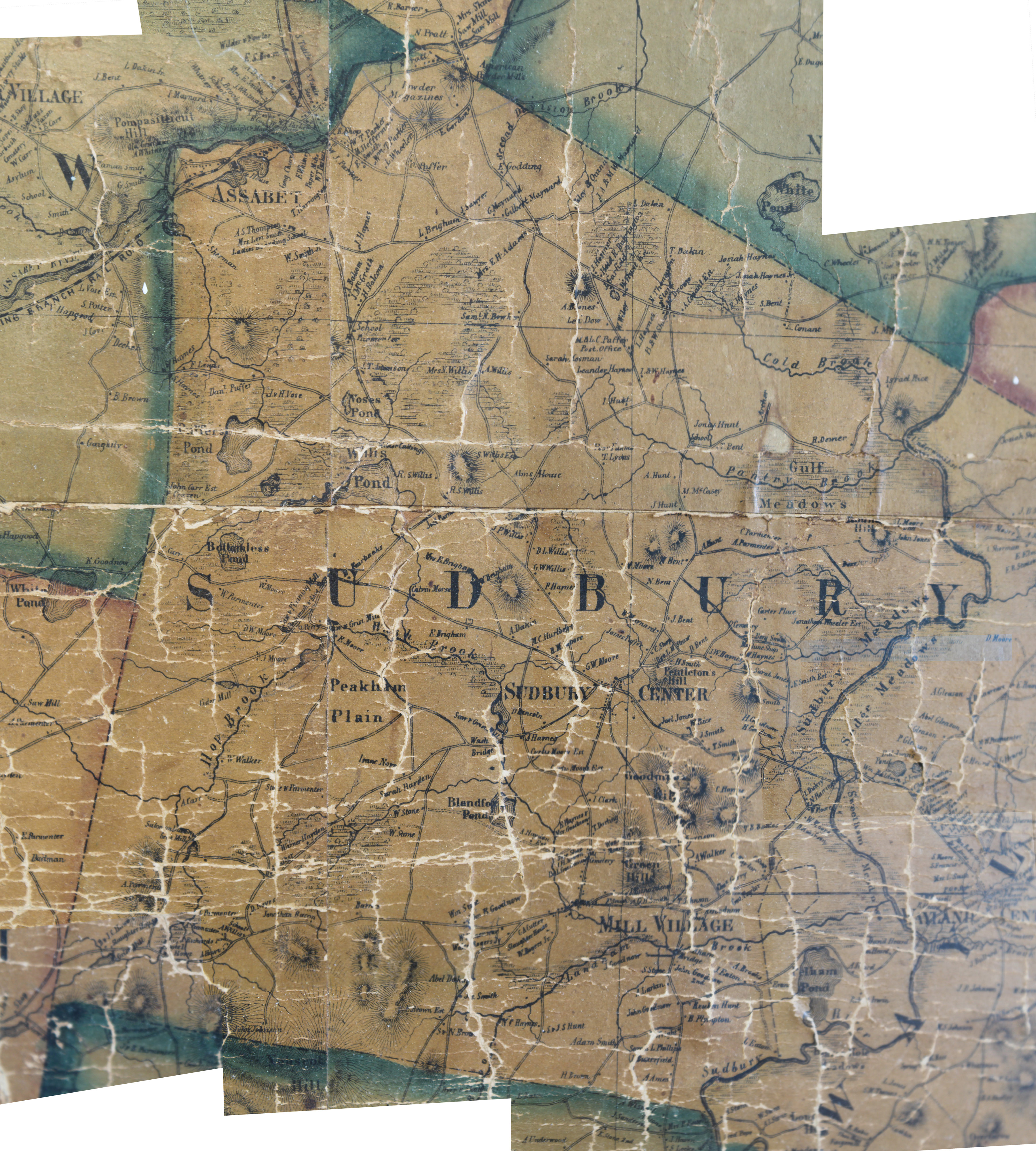
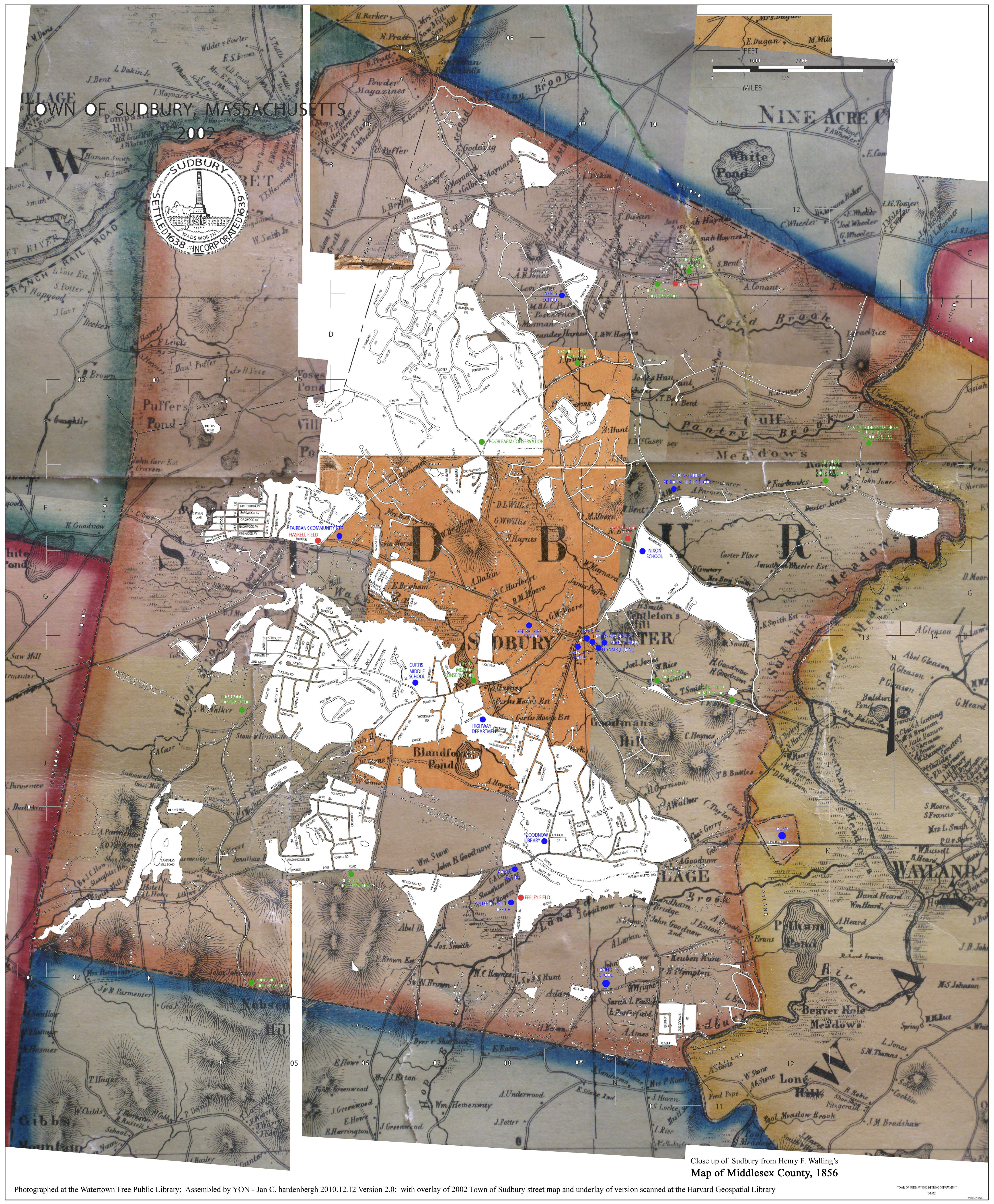
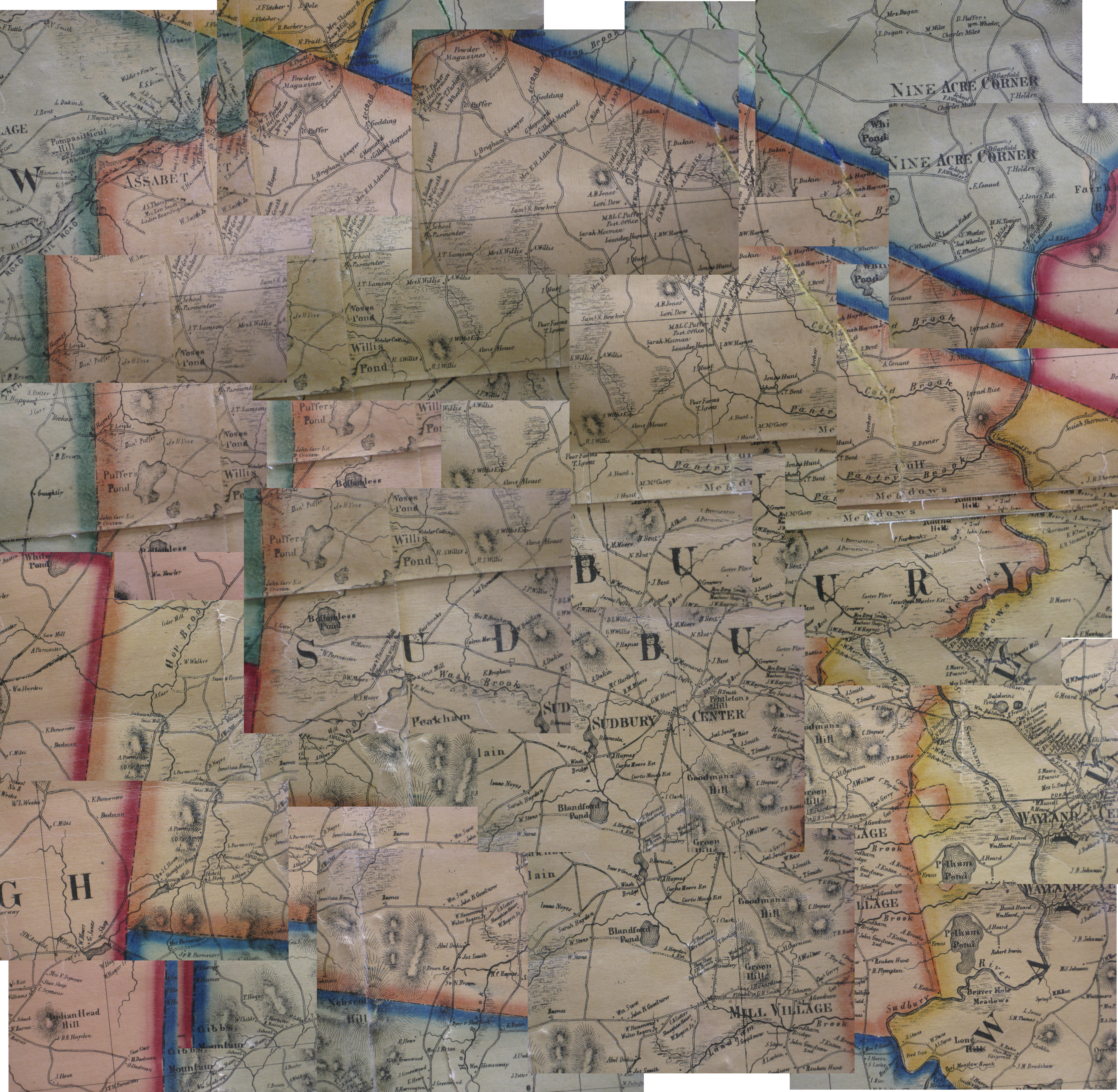
 I am getting ready to start Version 4.0 of the Close up of Sudbury from Henry F. Walling's Map of Middlesex County, 1856. It will go here: Historical Maps of Sudbury
I gave up on Version 4.0 and took photos of the Walling map in Sudbury Town Hall and Goodnow Library.
 Cap: SudburyTownHallWalling4k.jpg |
 Cap: SudburyTownHallWalling1856t.jpg |
|
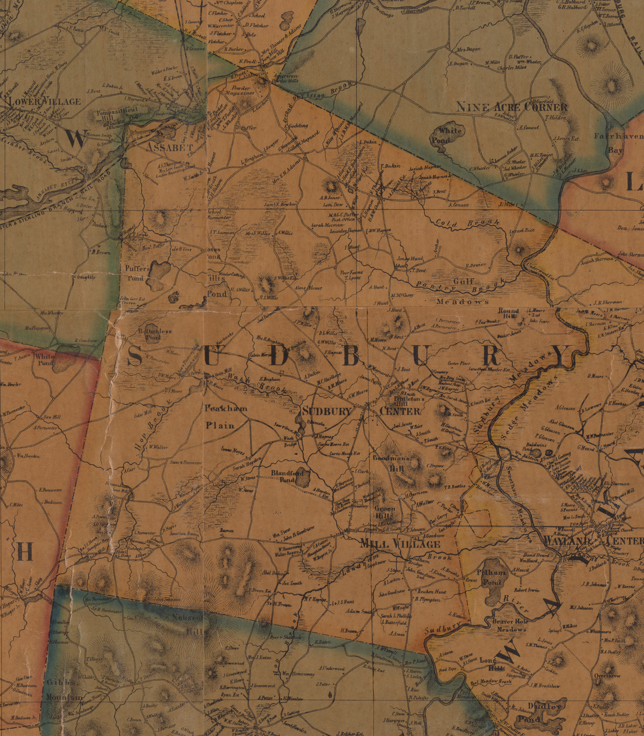
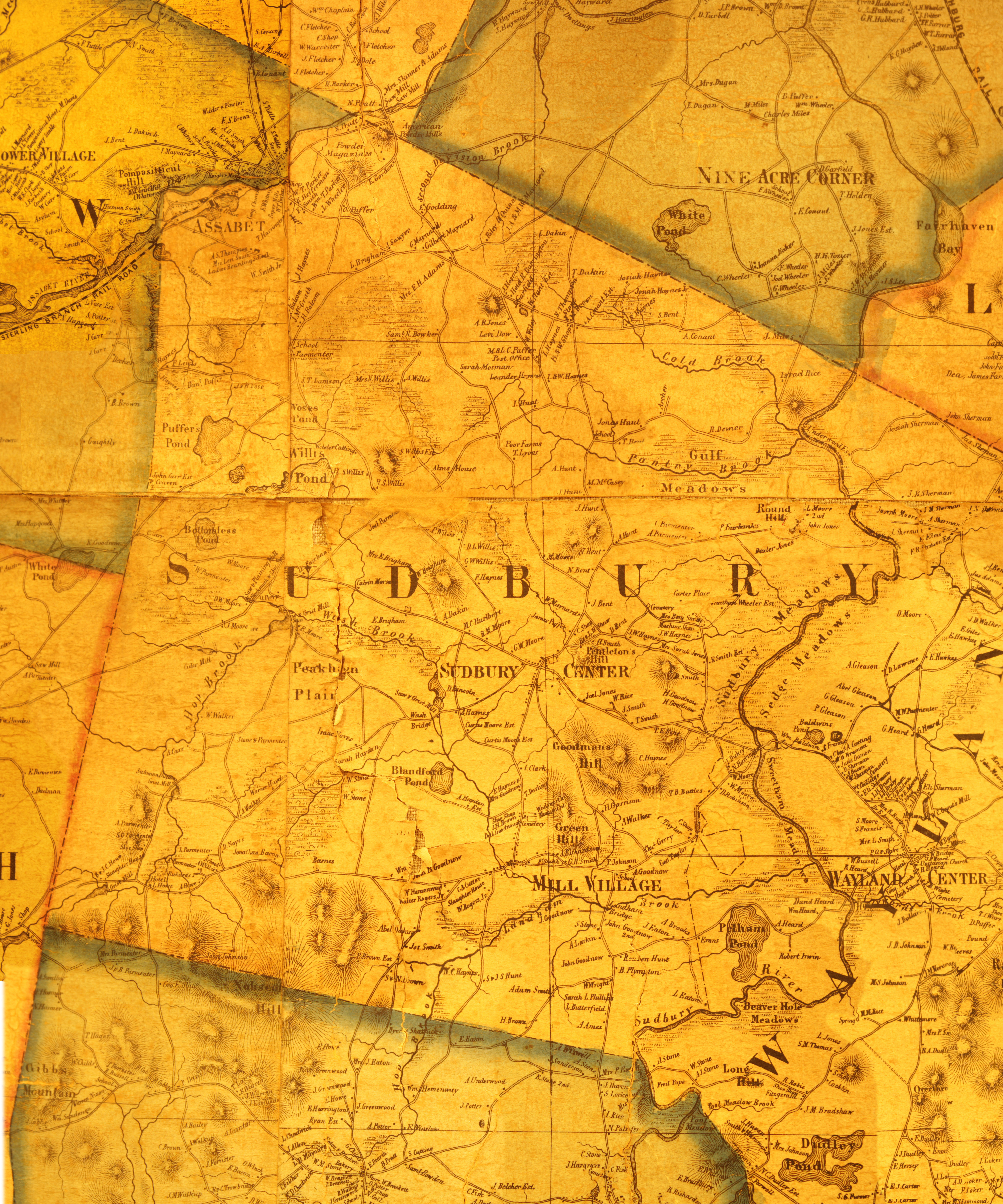
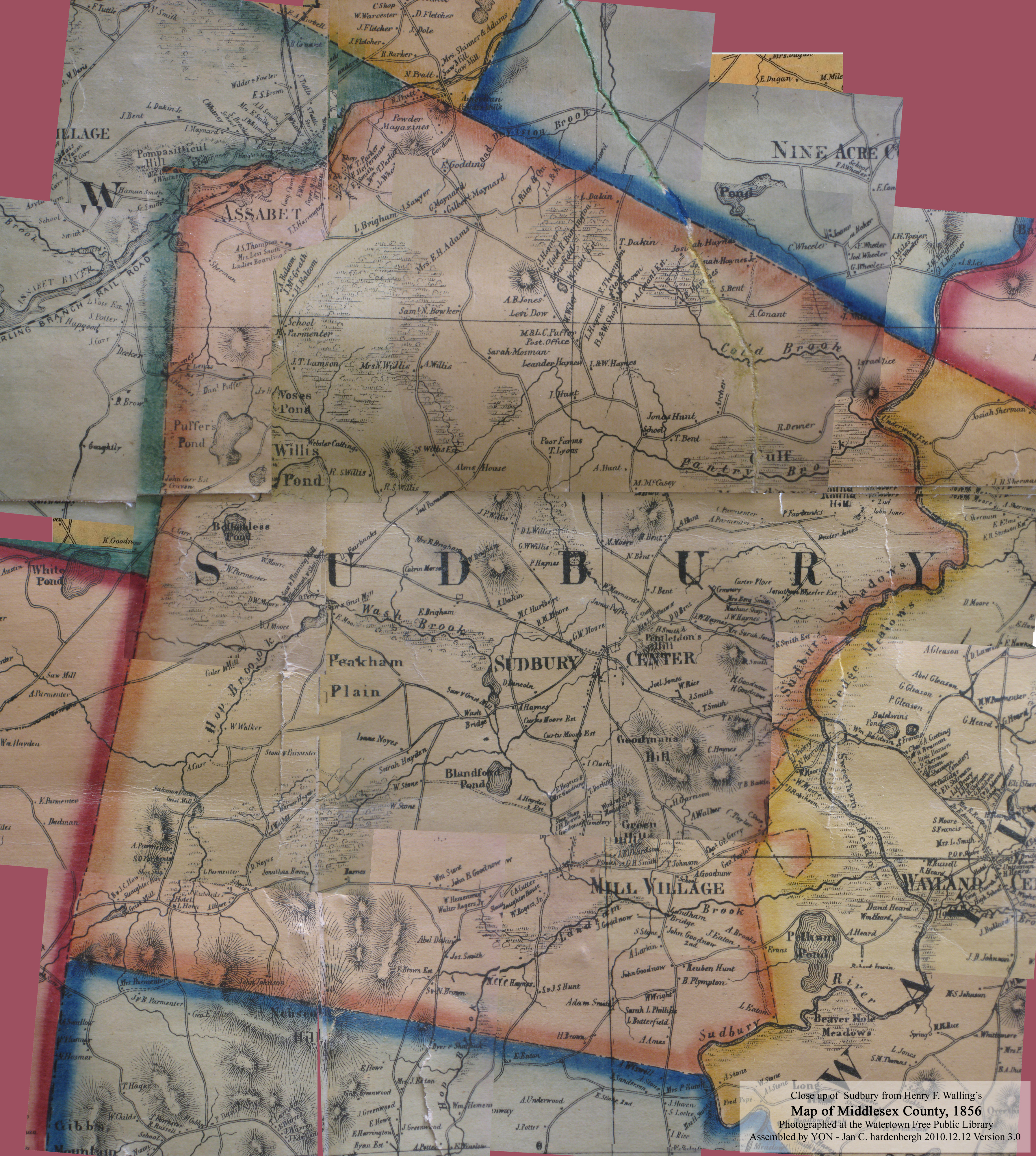
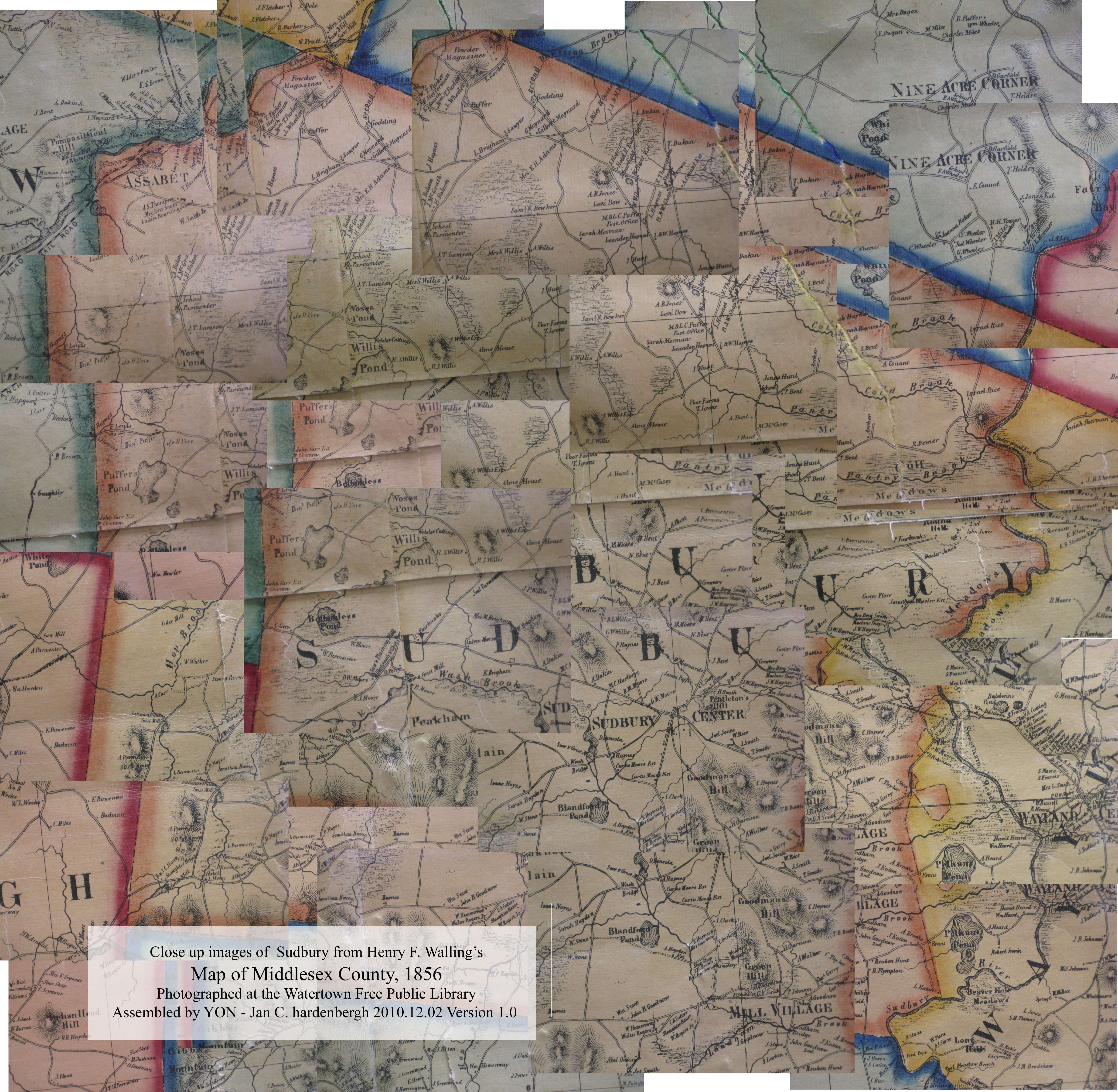
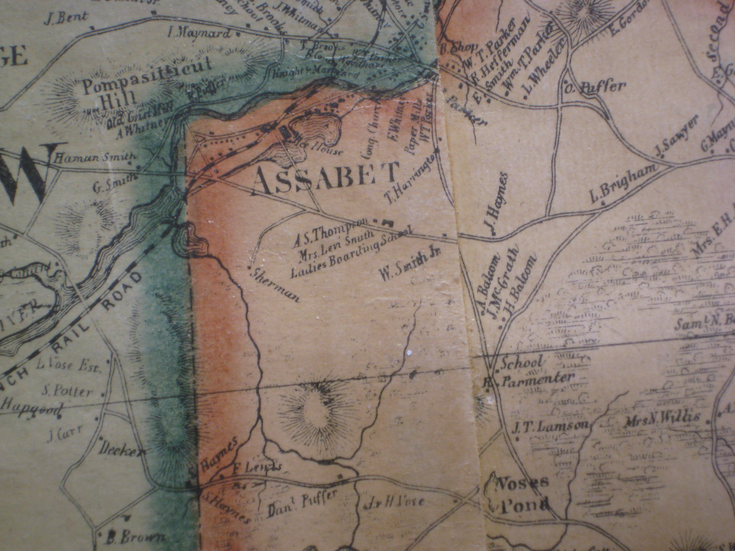
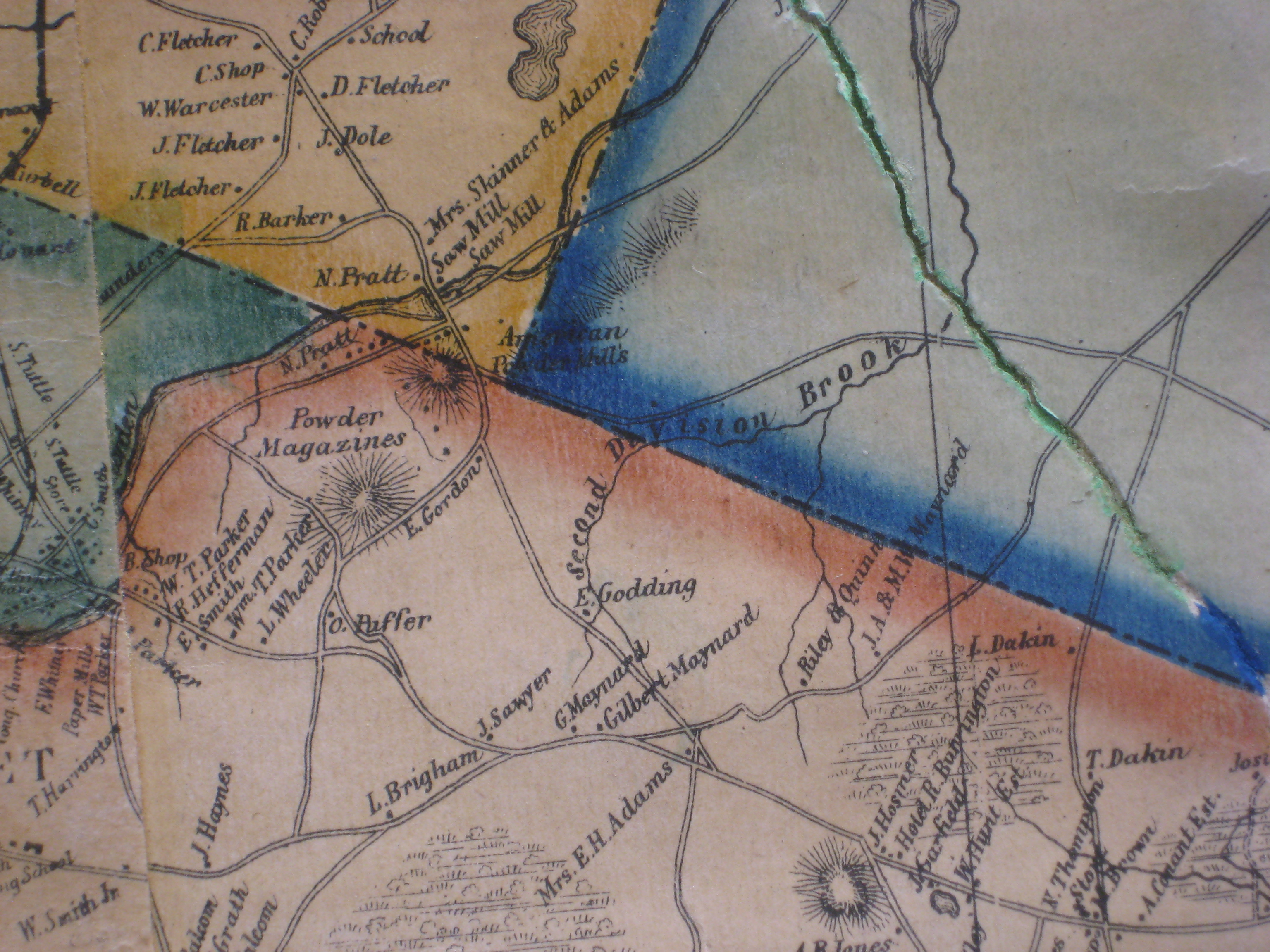
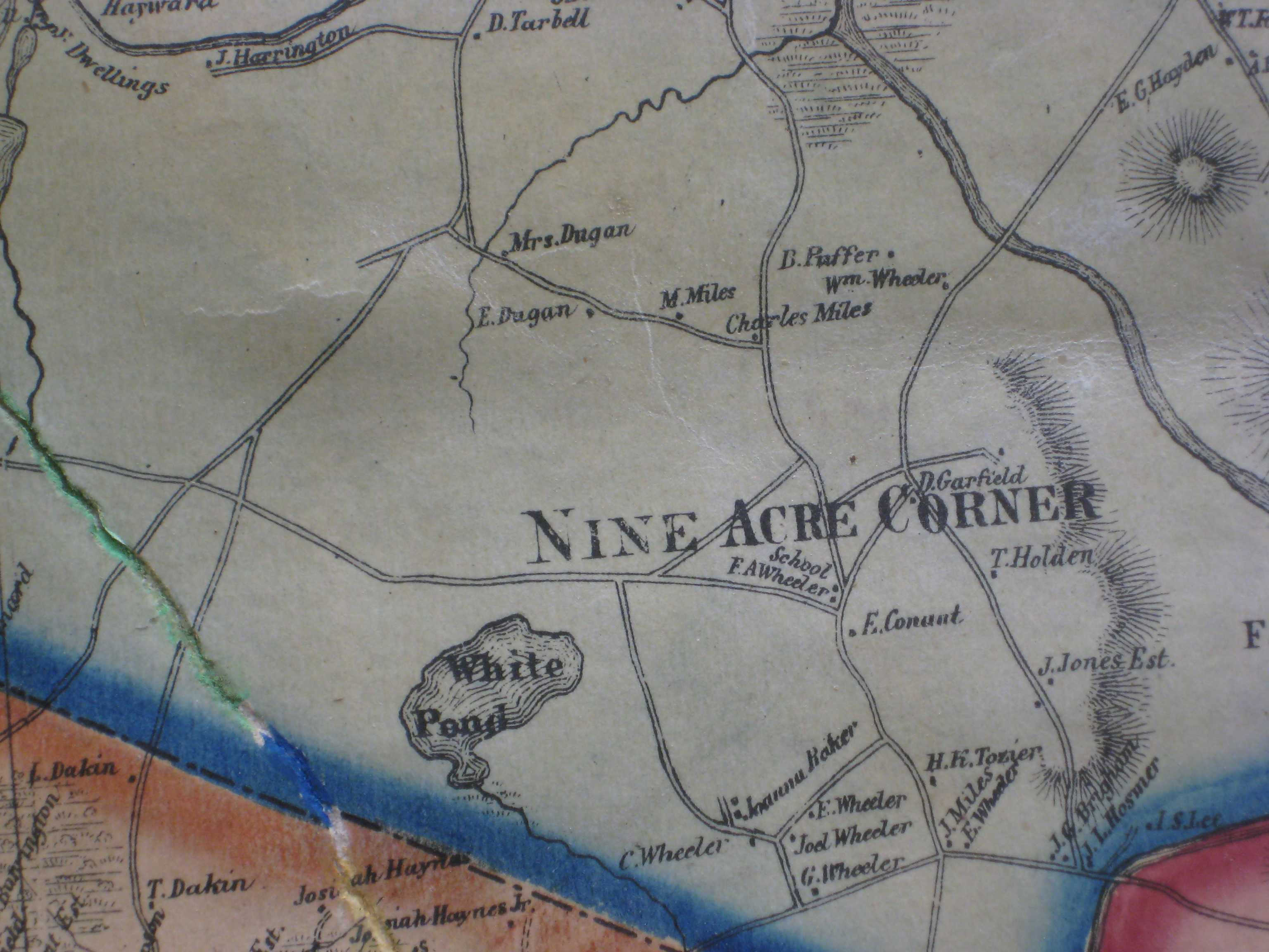
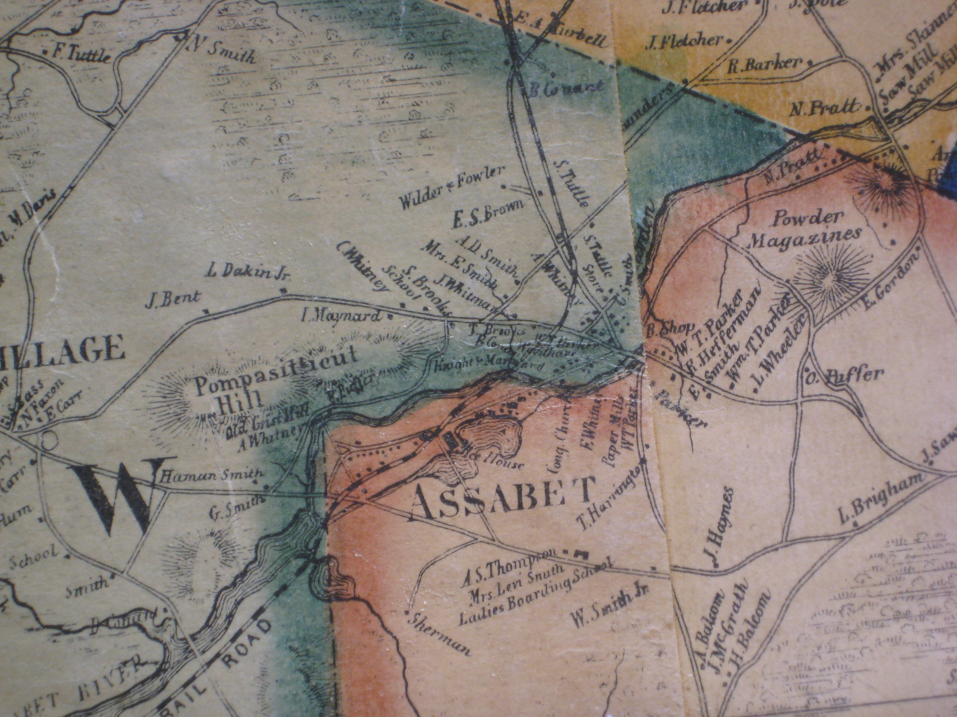
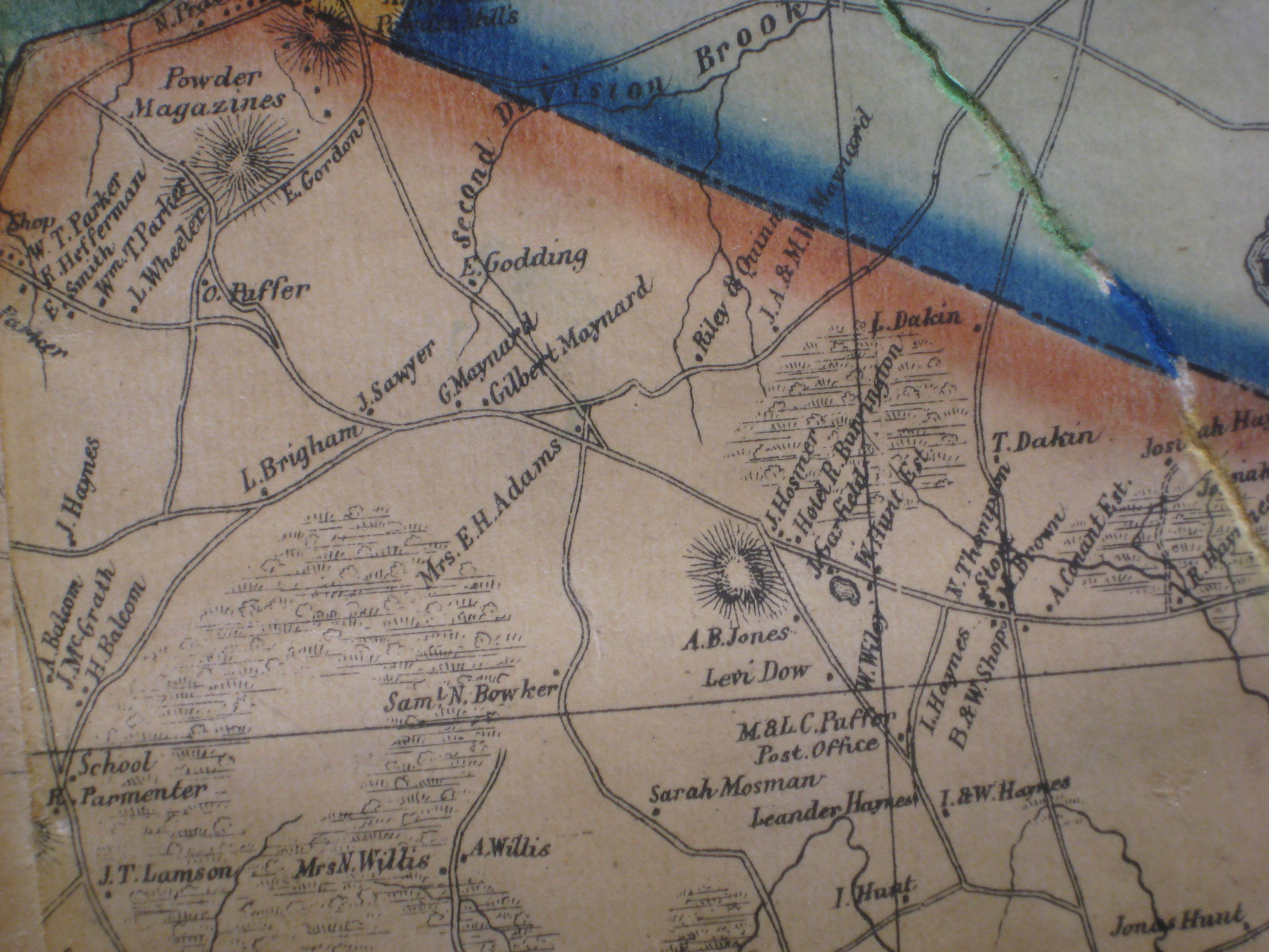
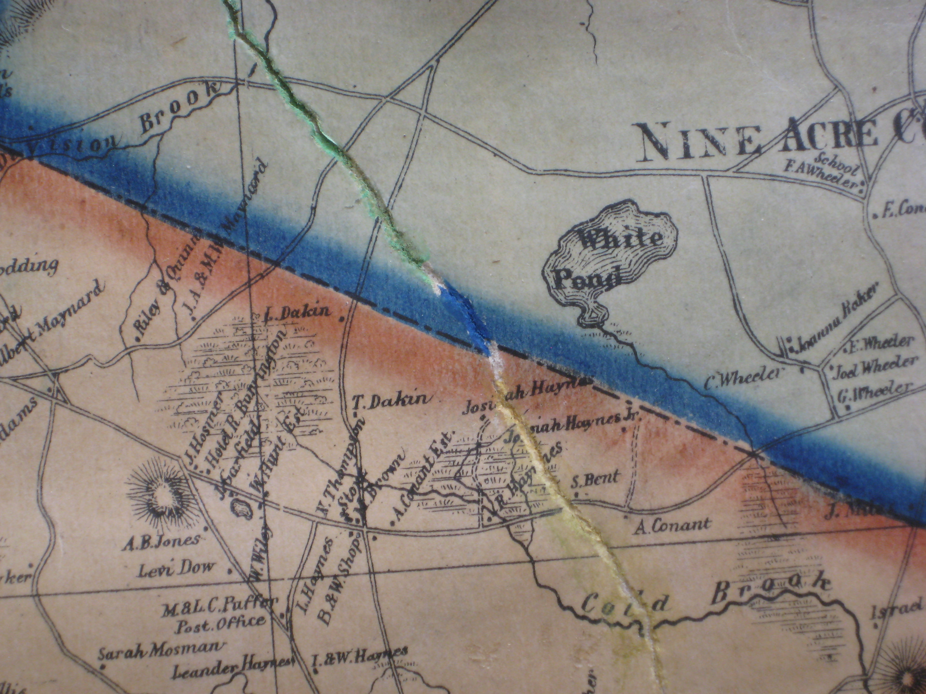
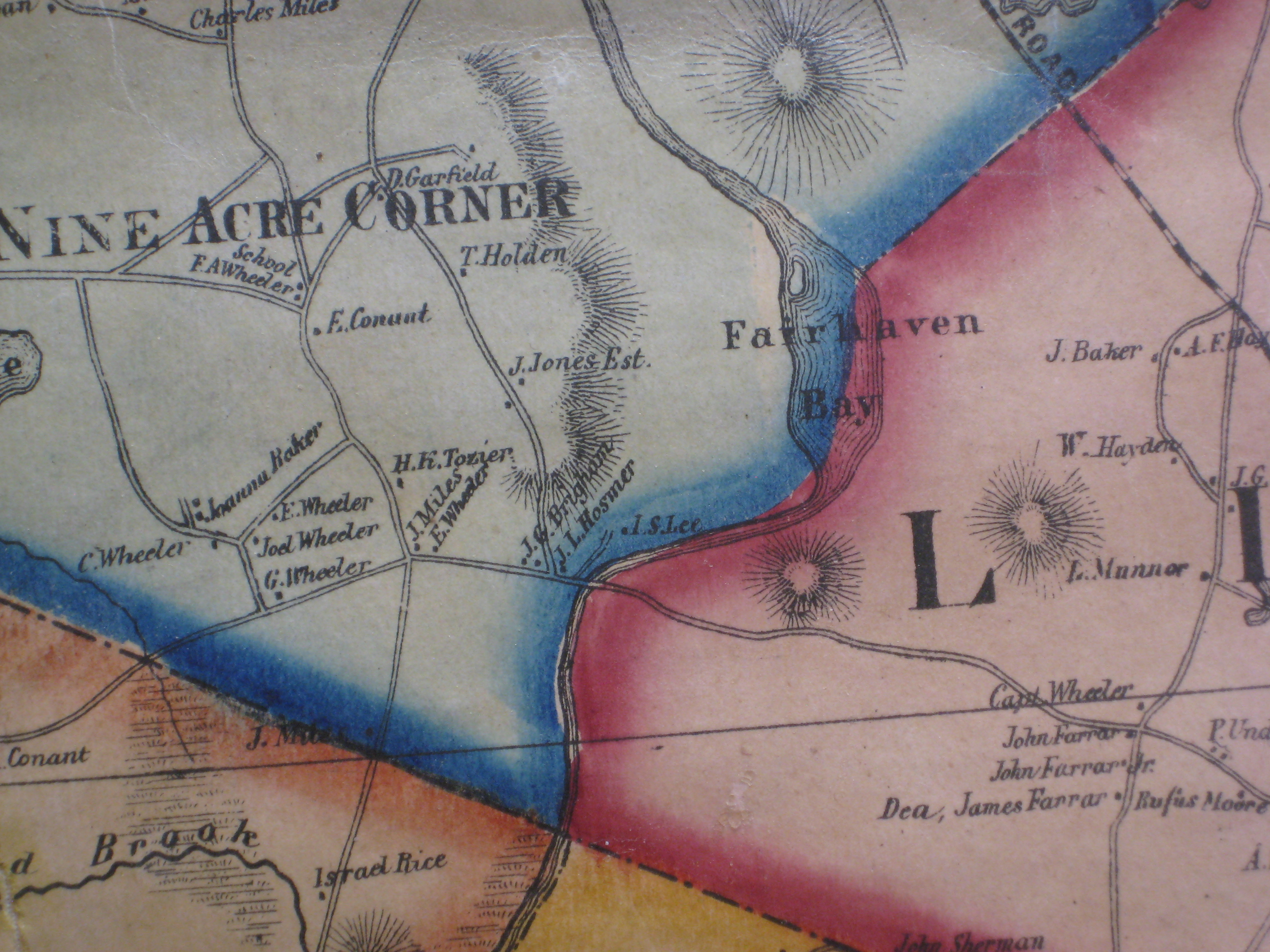
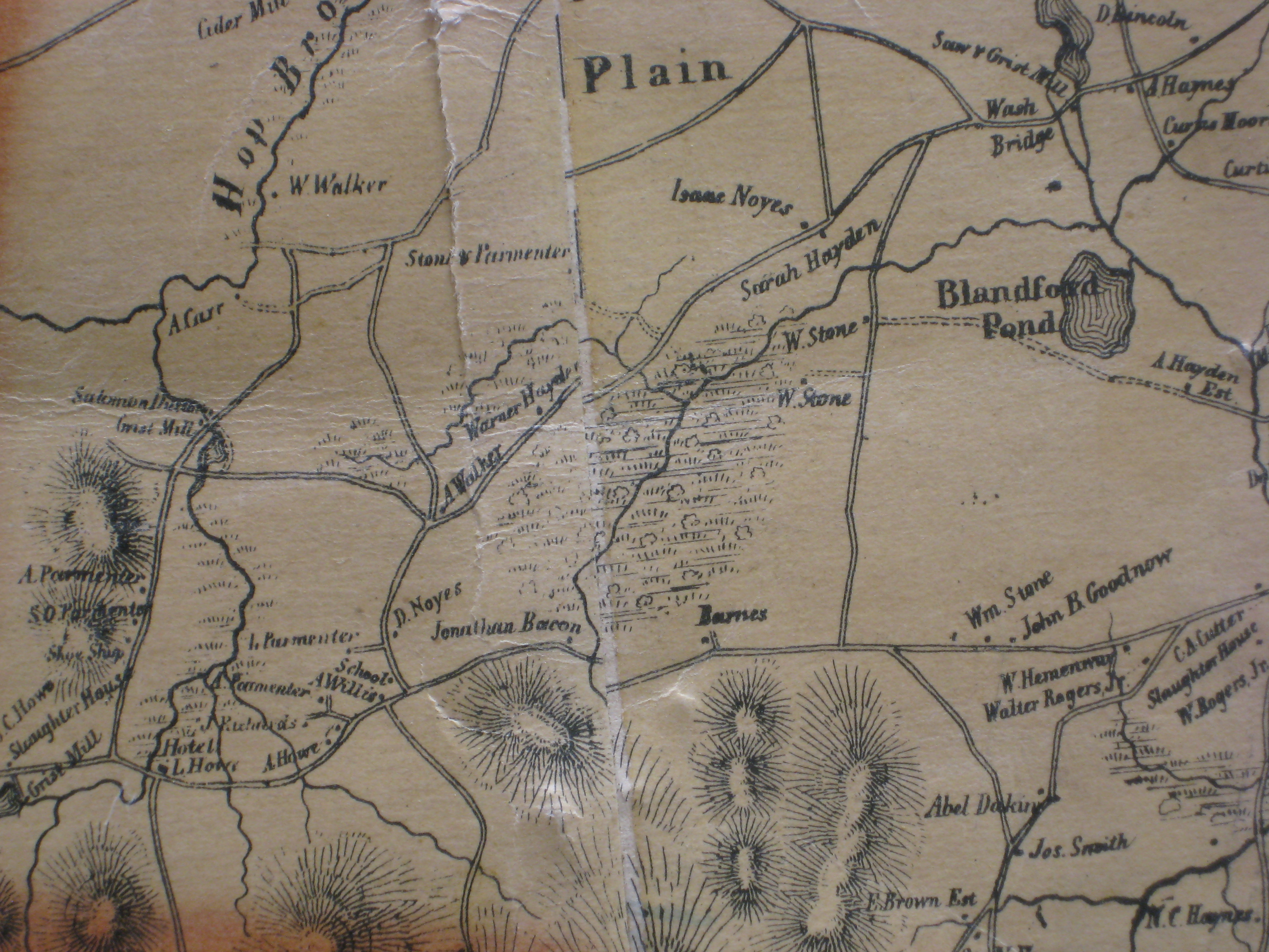
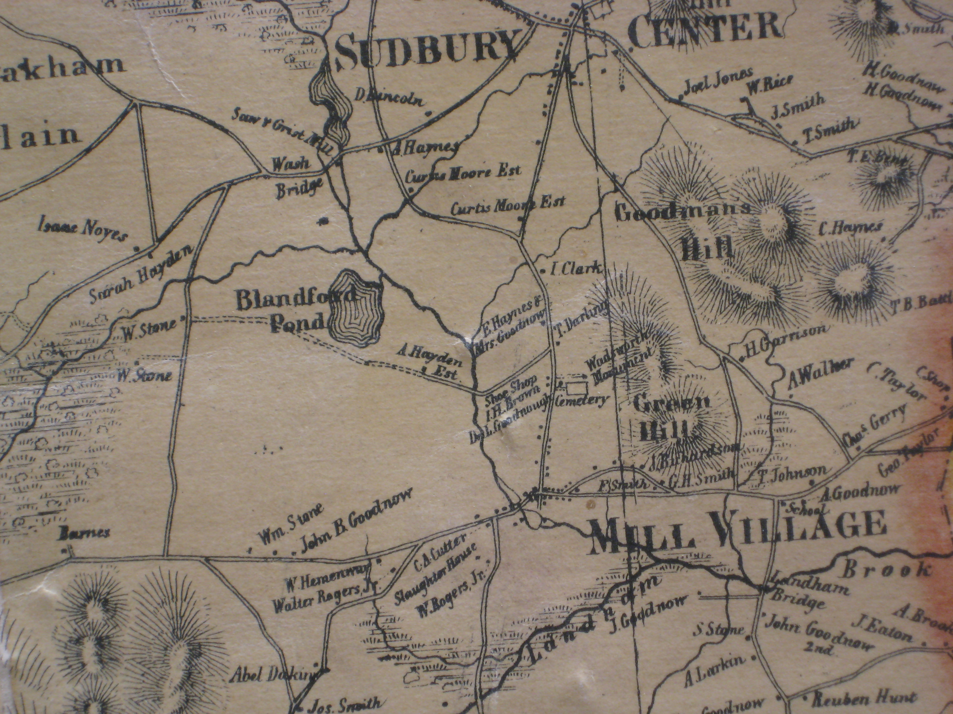
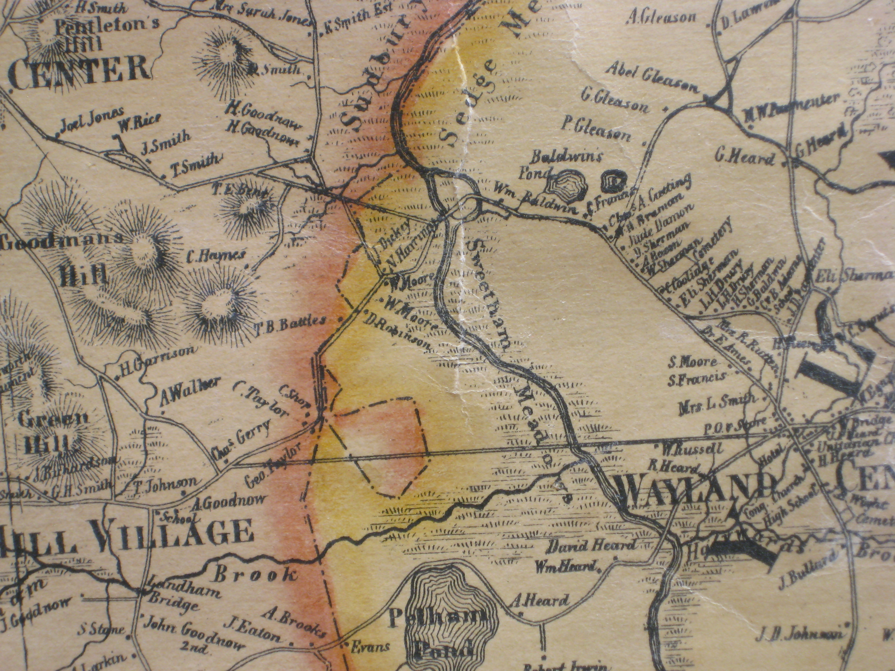
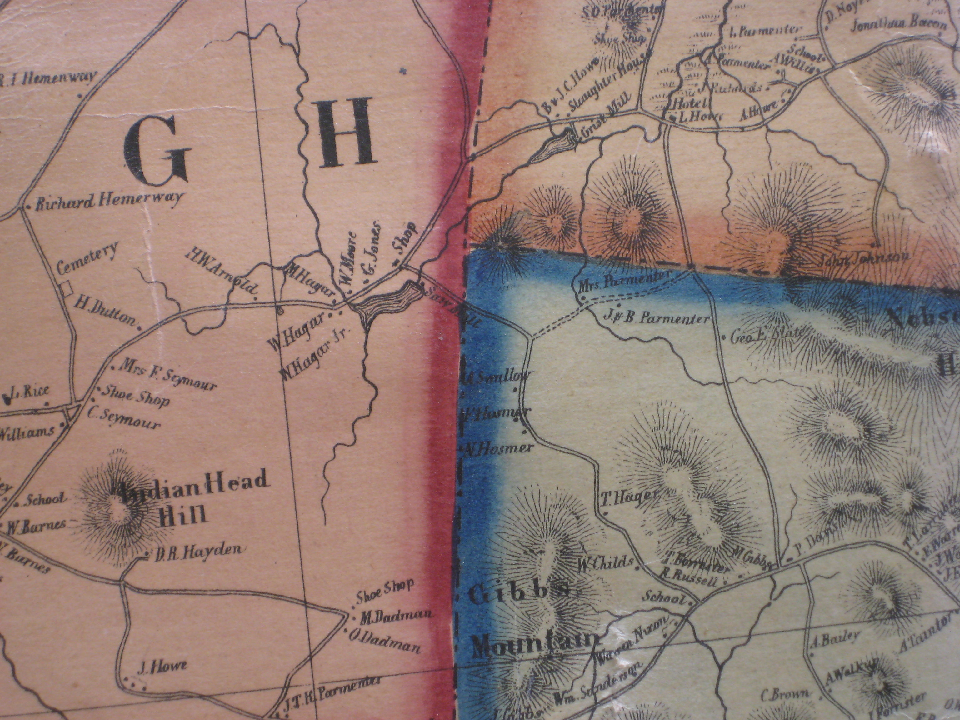
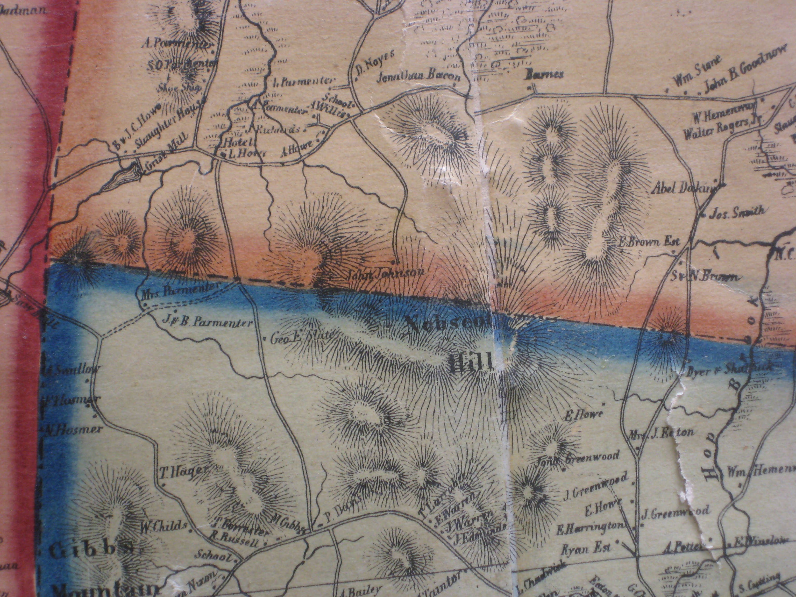
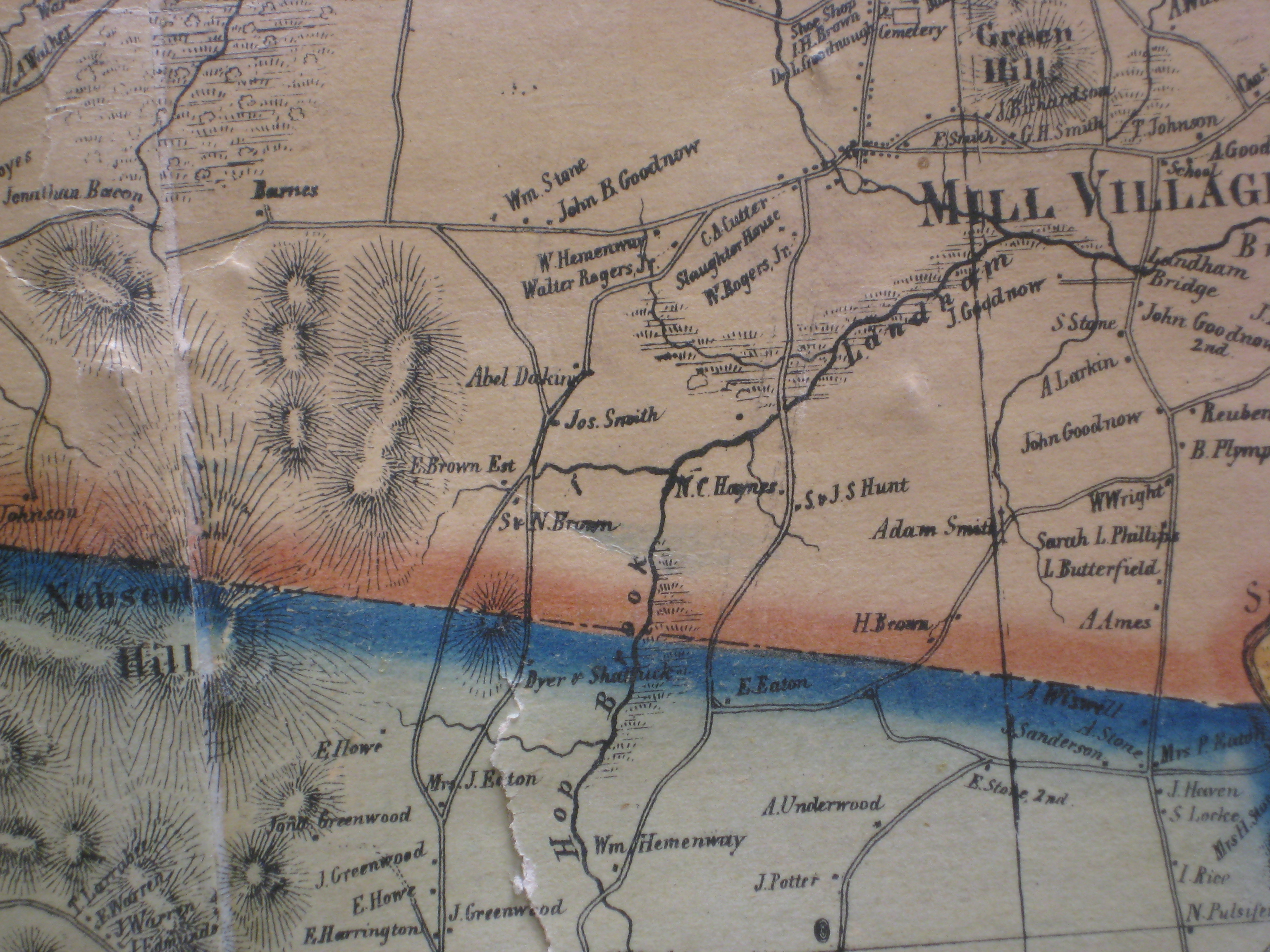
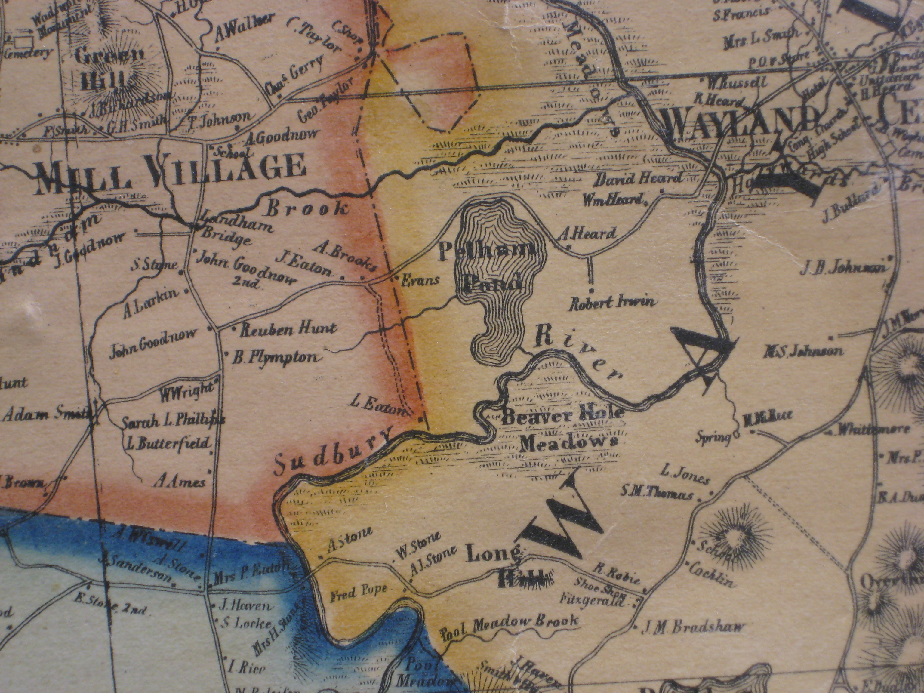
Close up of Sudbury from Henry F. Walling’s
Map of Middlesex County, 1856 Photographed at the Watertown Free Public Library Assembled by YON - Jan C. hardenbergh 2010.12.12 Versions 1.0 -> 3.0 On Dec 8, 2010, at 11:37 AM, Localhistory wrote: The Director pointed out we have a Permission to print policy (see attachment) and think this part pertains to your publishing. "Credit must be given to the Watertown Free Public Library and the creator of the work, if known. For web site use, credit should appear as a part of or next to the image." Thanks again for the photos, Kay Local History Librarian Watertown Free Public Library -----Original Message----- From: YON - Jan C. Hardenbergh Sent: Thu 12/2/2010 2:16 AM To: Localhistory Subject: Re: Walling's 1856 "Map of Middlesex County, Massachusetts" Here are two sizes of the same image. http://www.hardenbergh.org/places/sudbury/Watertown1856s.jpg (small) http://www.hardenbergh.org/places/sudbury/Watertown1856.jpg Just in case this is ever an issue, I assign the Watertown Free Public Library joint copyright for any purpose, including the right to assign joint copyright to anyone else. For my own part, this is a copy of Walling's work, so, in the public domain now and probably a work by Massachusetts, so, always in the public domain. Also, this came out well: Walling1856TownCenter.jpg And, here is the "before" picture: WallingWFLbefore.jpg It will take a while Thanx again! YON - Jan C. Hardenbergh <> www.jch.com <> Pixelsmith Jeff Lehman's five virtues: a love for complexity, a patient spirit, a will to communicate, a sense of humor, and an optimistic heart. |
 Walling WFPL v3 |
 Version 2.0 - figuring out that did not match |
 Before Starting - v1 |
Bonnie Burns, Librarian for Geographic Information Services, Harvard Map Collection
 Cap: IMG_2484.JPG |
 Cap: IMG_2487.JPG |
 Cap: IMG_2489.JPG |
|
 Cap: IMG_2485.JPG |
 Cap: IMG_2481.JPG |
 Cap: IMG_2479.JPG |
 Cap: IMG_2477.JPG |
 Cap: IMG_2469.JPG |
 Cap: IMG_2471.JPG |
 Cap: IMG_2473.JPG |
 Cap: IMG_2475.JPG |
 Cap: IMG_2467.JPG |
 Cap: IMG_2466.JPG |
 Cap: IMG_2462.JPG |
 Cap: IMG_2460.JPG |
 Cap: IMG_2454.JPG |
 Cap: IMG_2456.JPG |
 Cap: IMG_2458.JPG |
|
 Cap: IMG_2452.JPG |
 Cap: IMG_2450.JPG |
 Cap: IMG_2449.JPG |
 Cap: IMG_2447.JPG |
 Cap: IMG_2439.JPG |
 Cap: IMG_2440.JPG |
 Cap: IMG_2442.JPG |
 Cap: IMG_2444.JPG |
mkthumps.py Sat, 04 Dec 2010 YON Jan C. Hardenbergh