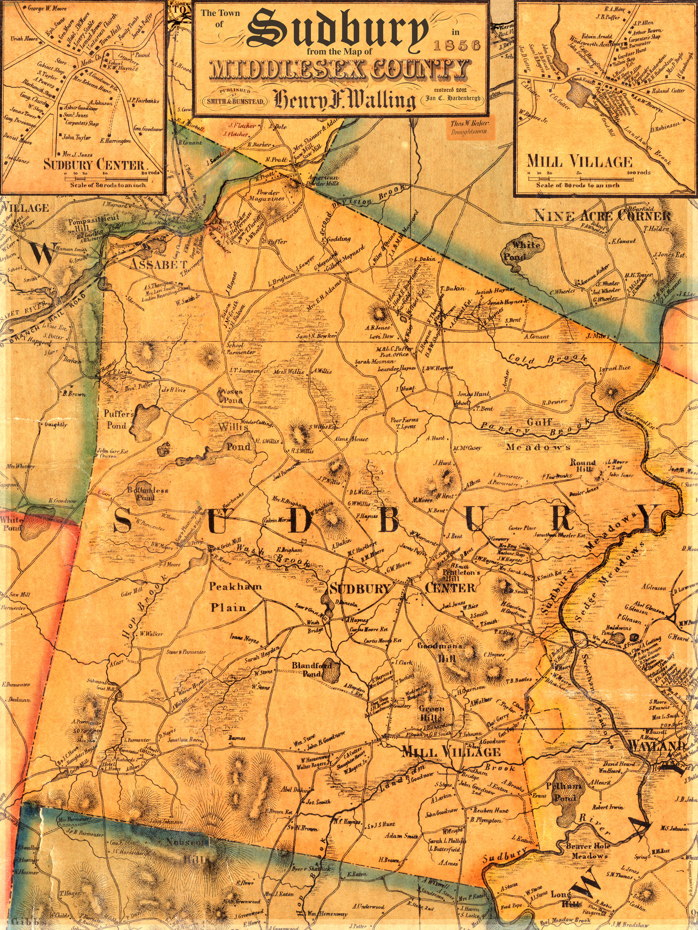
The complete name of the map for reference purposes is The Map of Middlesex County, H.F. Walling, 1856, henceforth known as the map.
The title box was created from elements of the original title area of the map, which is shown below. In addition, I have added the following pieces of text: "The Town of Sudbury in", "from the Map of" and "Scanned 2012 Jan C. Hardenbergh". The pixels rendering 1856, Henry F. Walling, MIDDLESEX COUNTY, and Smith & Bumstead are original pixels, altho some have been scalled more than others.
Why do I have the gall to put my name in the title box? Because I have spent close to 60 hours on my Walling and much more than that the 3 other versions that I created from photographs. This map is offered for free, as is.
The other 3 minor elements are the Draughtsman just below the title box and two instances of jch.com/sudbury
The result is the image on the right. You can clearly see the East/West seem and the North/South seem. The map is made up of 16 separate pieces of paper, which makes a lot of sense since a 5'x5' printing press. I'm only 94% certain that the number of pieces is 16. In my copy, the Southeast corner is over inked, the Southwest corner is a little light. The crease along the Marlboro border is the worst of the damage, but, not back compared to other versions of the map.
 The full map |
 Scanning My Walling |
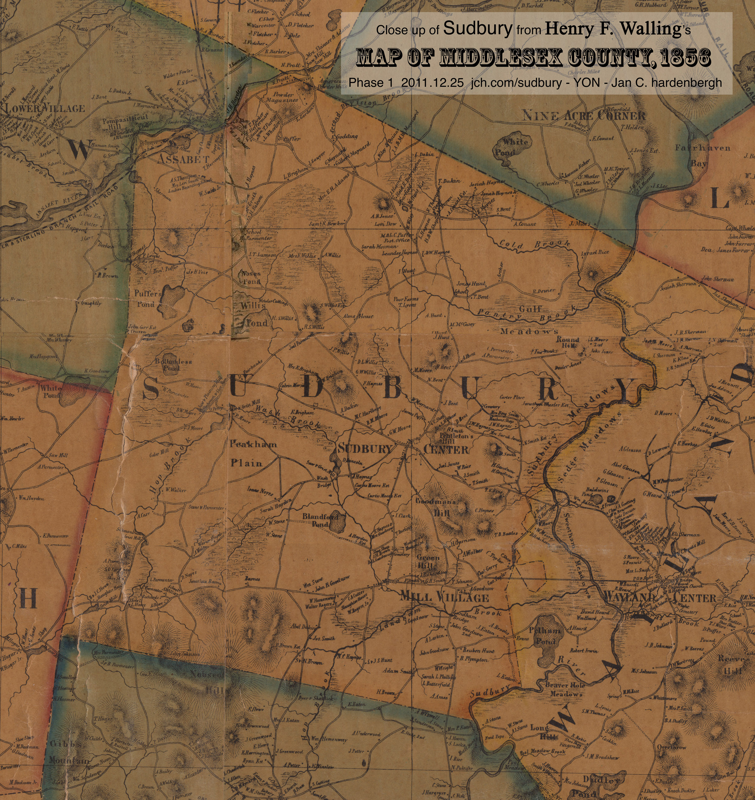
 Phase 0 - the original scan |
 Phase 1 |
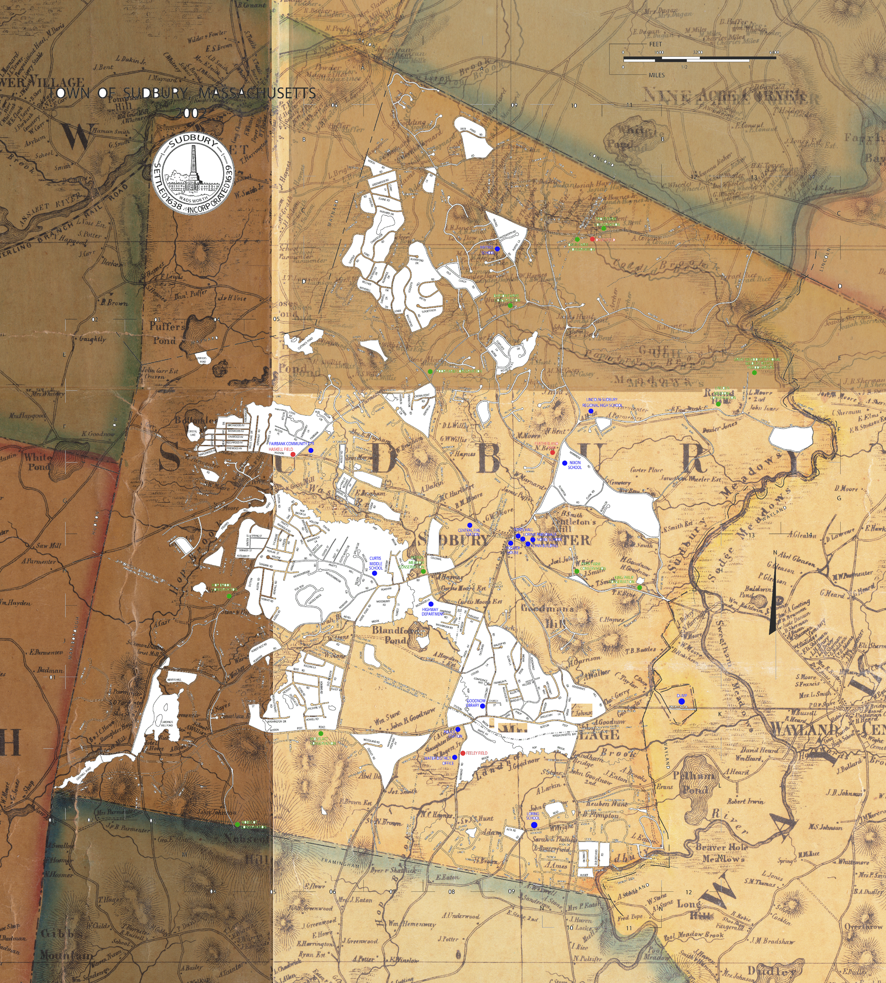 Trying to align a current town map to Phase 1 |
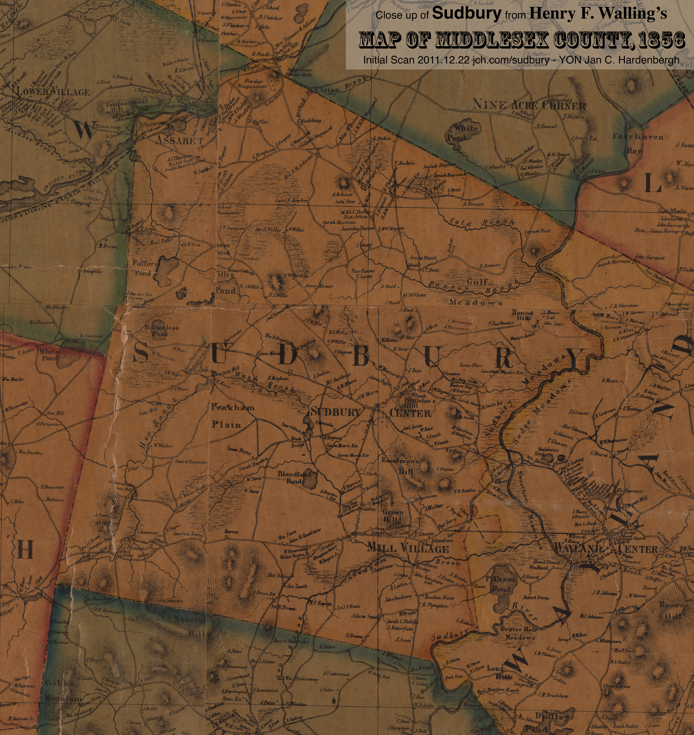
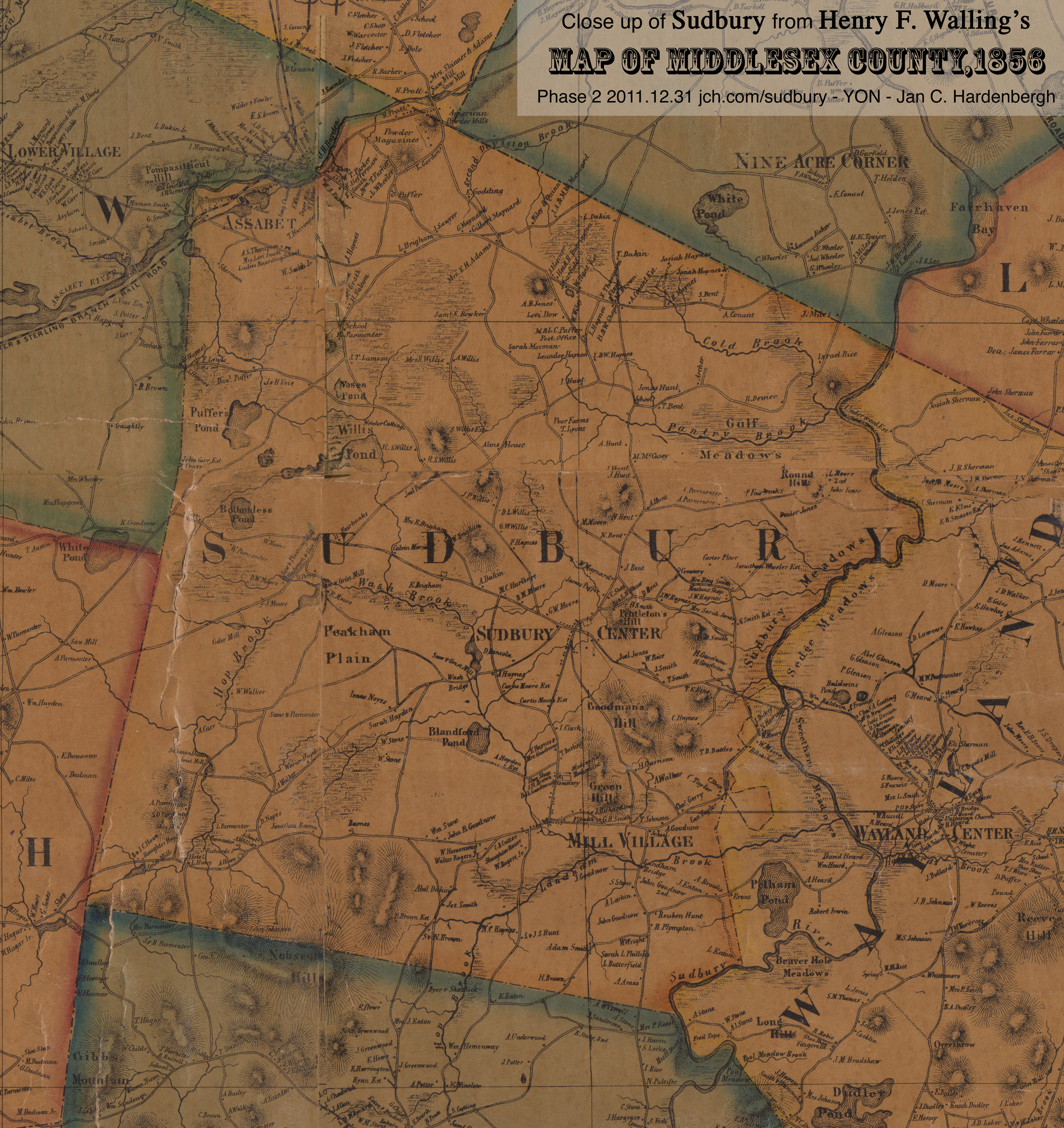 Phase 2 - rectified |
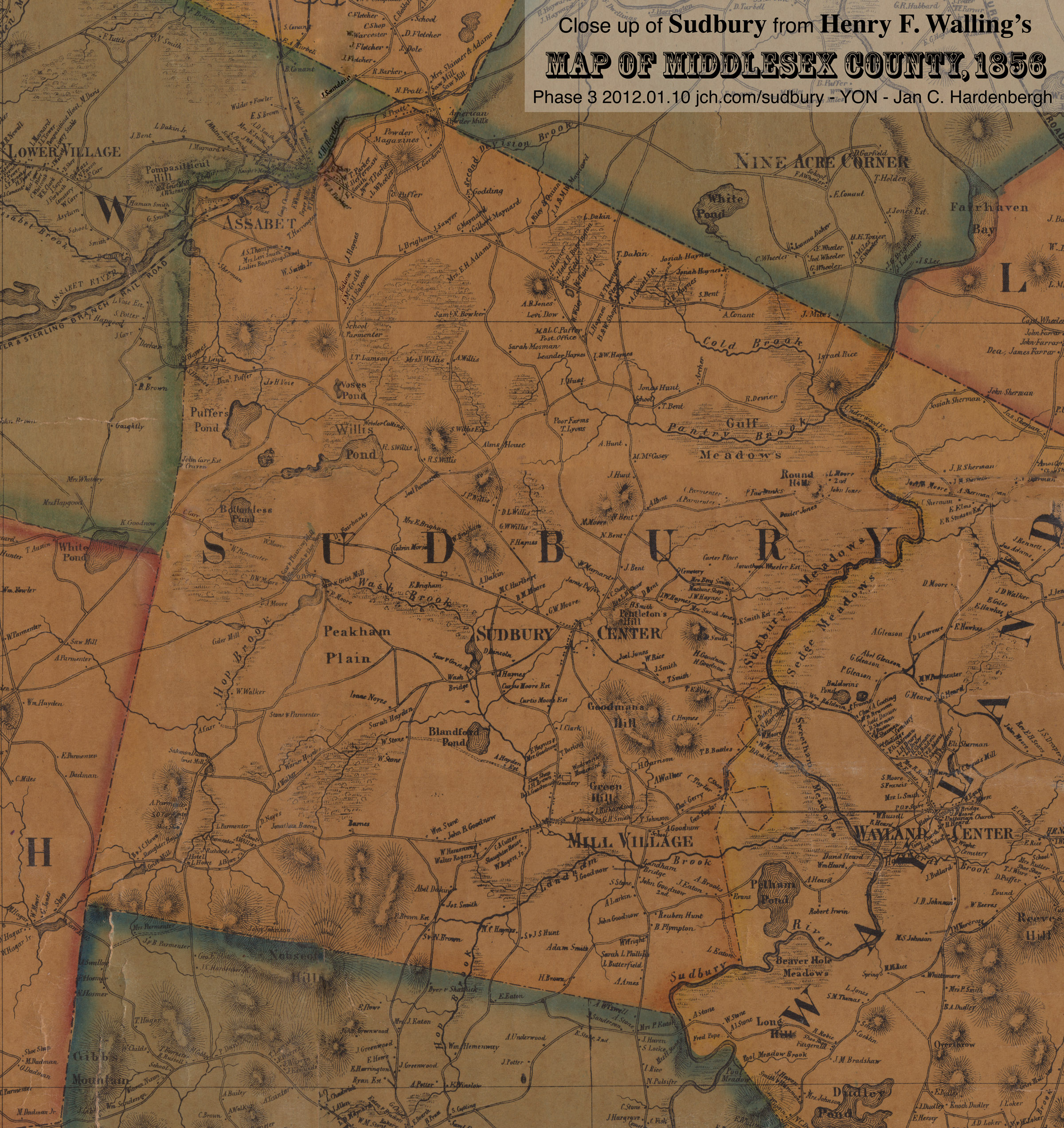
There were two instance in which one piece had half of a hill and the other piece did not match it. One was on Willis road and the other in what is now Maynard, which did not split off until 1871. For these, I added the other half of the hill.
Other than that, I removed the crease and cleaned up anything that was visually distracting. It is an interesting exercise to put the 4 phases in 4 tabs on your web browser and flip between them. You can clearly see what was changed.
So, did I destroy the authenticity of the map? I do not think so. The Town of Sudbury was on 4 different pieces and they did not meet perfectly on any know copy of the map AND even when they did there were mismatches!
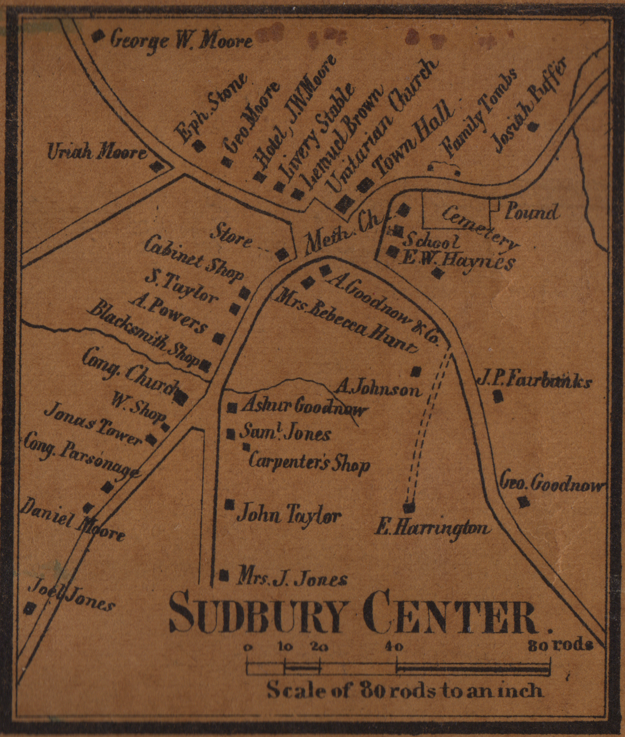 Cap: Walling1856SudburyCenter.jpg |
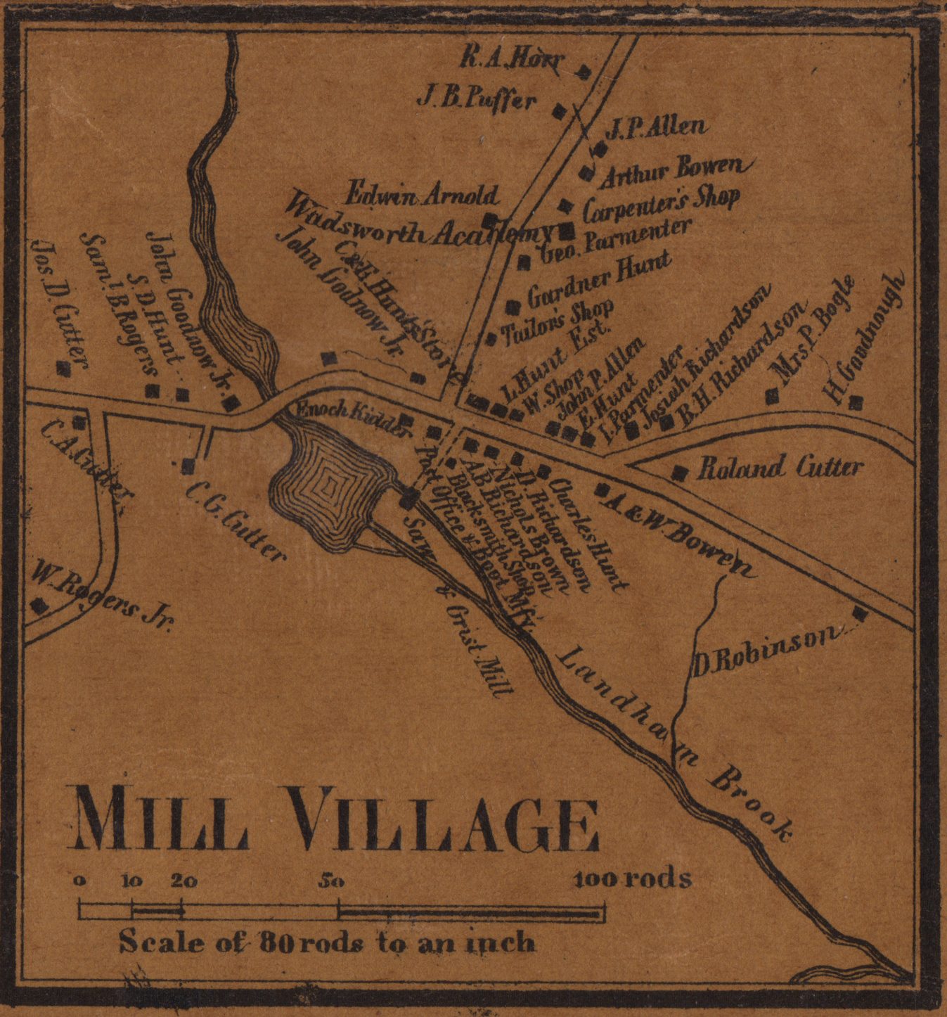 Cap: Walling1856MillVillage.jpg |
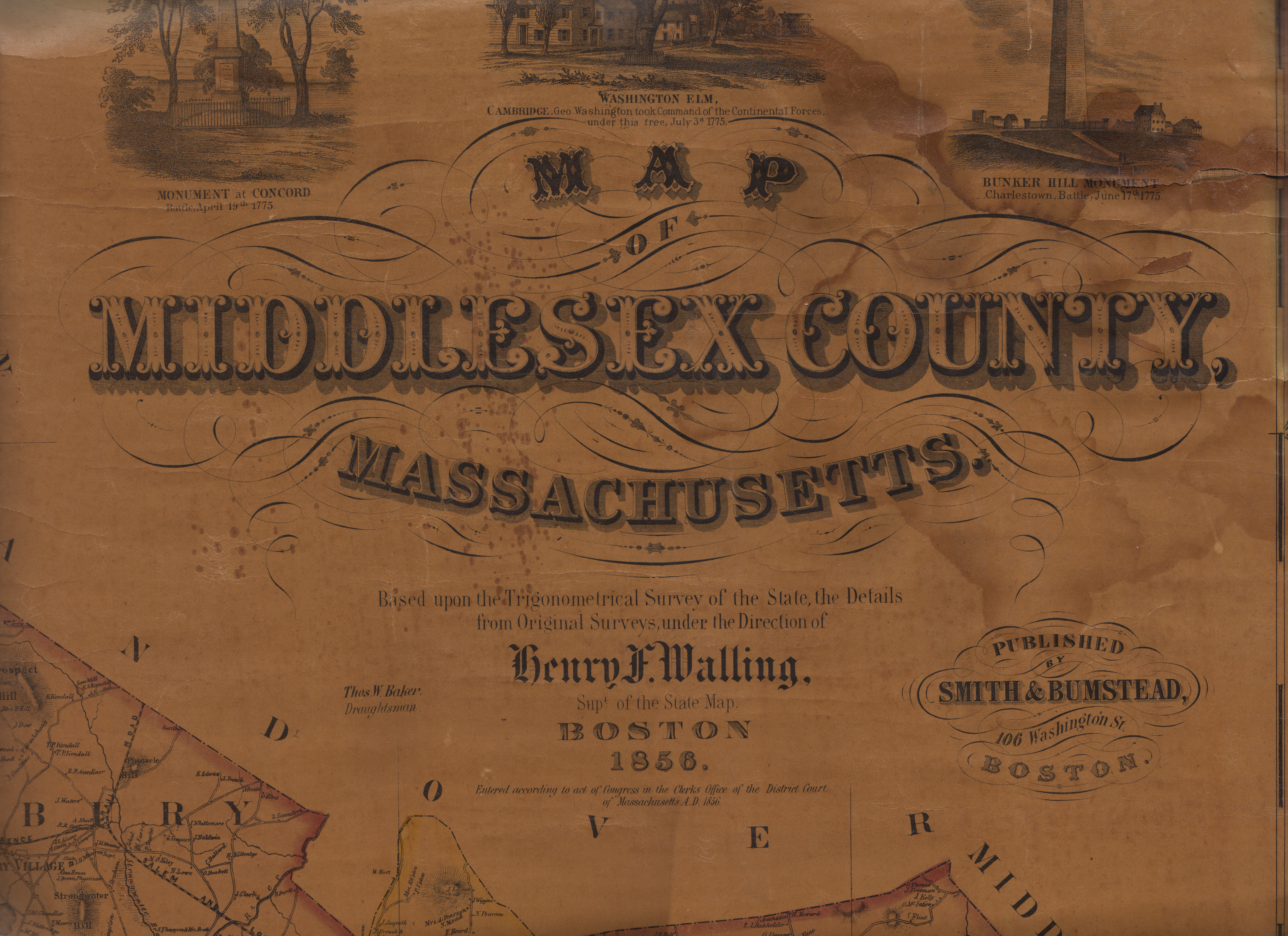 Cap: Walling1856Title.jpg |
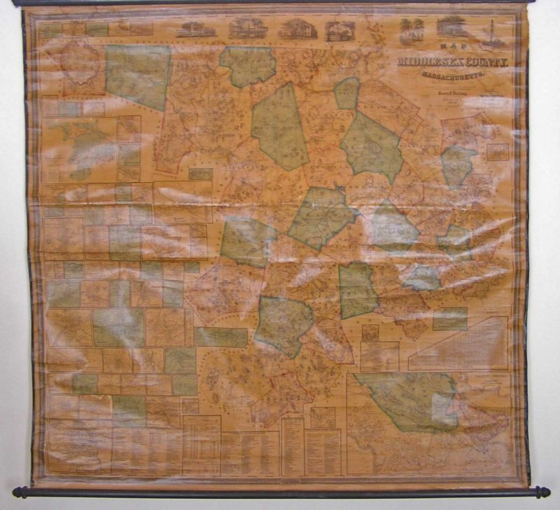
The reproduction I have is from the Havard scan. Unfortunately, Sudbury is right in the middle, so, any folded versions are missing a good chunk of Sudbury. Same with the BPL version. And the original sheets meet in Sudbury, too. In addition to the Harvard & BPL versions, I have seen one for sale by a dealer that did not have good detail of Sudbury. I have photographed the one at the Watertown Free Library - rolled with lacquer - Sudbury not too bad. There is a mounted version in the Sudbury Town Hall that is in poor condition and the copy in the Goodnow Library is in fair condition. I have also determined that I will never get a satisfactory result by photographing - at least not without a significant improvement in equipment and methodology. I was quite careful at Goodnow, but...
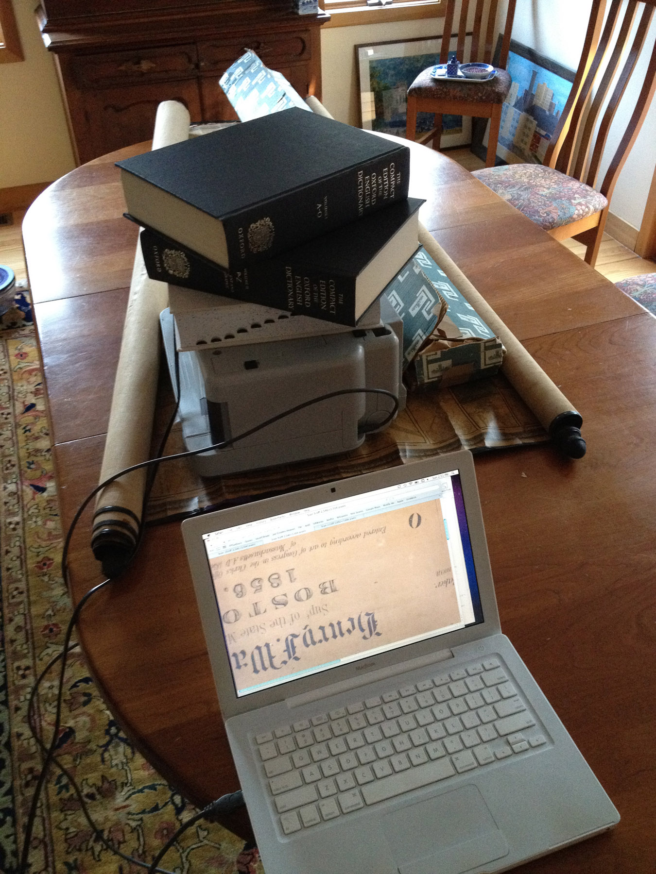
So, I drove out to Boylston MA on December 18th, 2011, and the Sudbury portion of the map was in good condition. The map over all is in good condition - with a bit of water damage at the top. Photo attached. So, I bought it, moving me from hobbyist to investor. Sort of. My primary goal is to get a clean hi-res scan of Sudbury. I am hoping to sell it at some point in the future.
Other Notes
The typeface in the title box is a mishmash, as is the type in the original map. Walling, Bumstead, Middlesex and 1856 are all images copied from the original. The new test is times and and 2 fonts from http://www.steffmann.de/ - Cloister Black and Deutch Zierschrift.
sudbury $ md5 Sudbury1856Walling.jpg
MD5 (Sudbury1856Walling.jpg) = 25b1fb98e35848e02f21ba9fd89b8d15
2012.02.06 YON