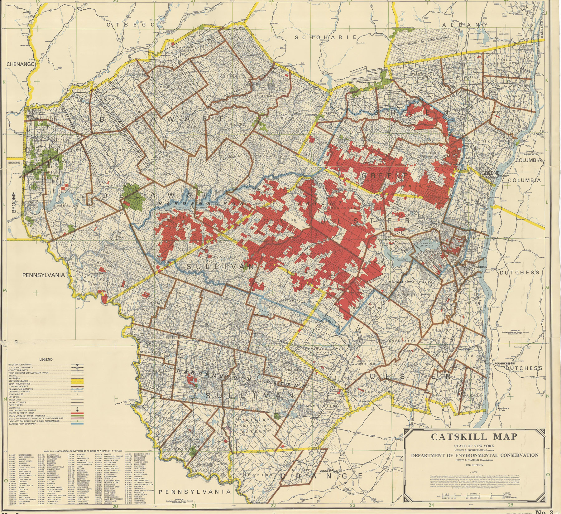
 1970 Catskill Land Map courtesy of Robert A. Burgher, Bureau of Real Property, New York State Department of Environmental Conservation
This is the description by Alf Evers:
Catskills Map. Published by the New York State Conservation Department, Albany, 1957. This map revised from earlier editions going back to 1899, shows patent and lot lines as well as subdivisions often as small as an individual farm. State-owned lands are indicated.
And another description from Catskill Mountain News in 1939:
A new edition of the Adirondack and Catskill land maps showing all state-owned land in the Forest Preserve has been prepared. The maps are of particular value in showing the boundary lines of land grants and patents, as well as the location of state land in the Forest Preserve.First published about 30 years ago by the Forest, Fish and Game commission, the maps have from time to time been improved and the present edition according to Conservation Department officials represents a great deal of time and effort in correcting inaccuracies contained in previous editions. Maps of both regions have been drawn to a scale of two miles to the inch. The director of the budget has set the price of the Adirondac map at $3.00 and the Catskill map at $2.00. Copies may be obtained by writing to the Secretary of the Conservation Department at Albany.
So, we know there were editions in 1899, 1911, 1939, 1957, 1970, 1983 and 1985.
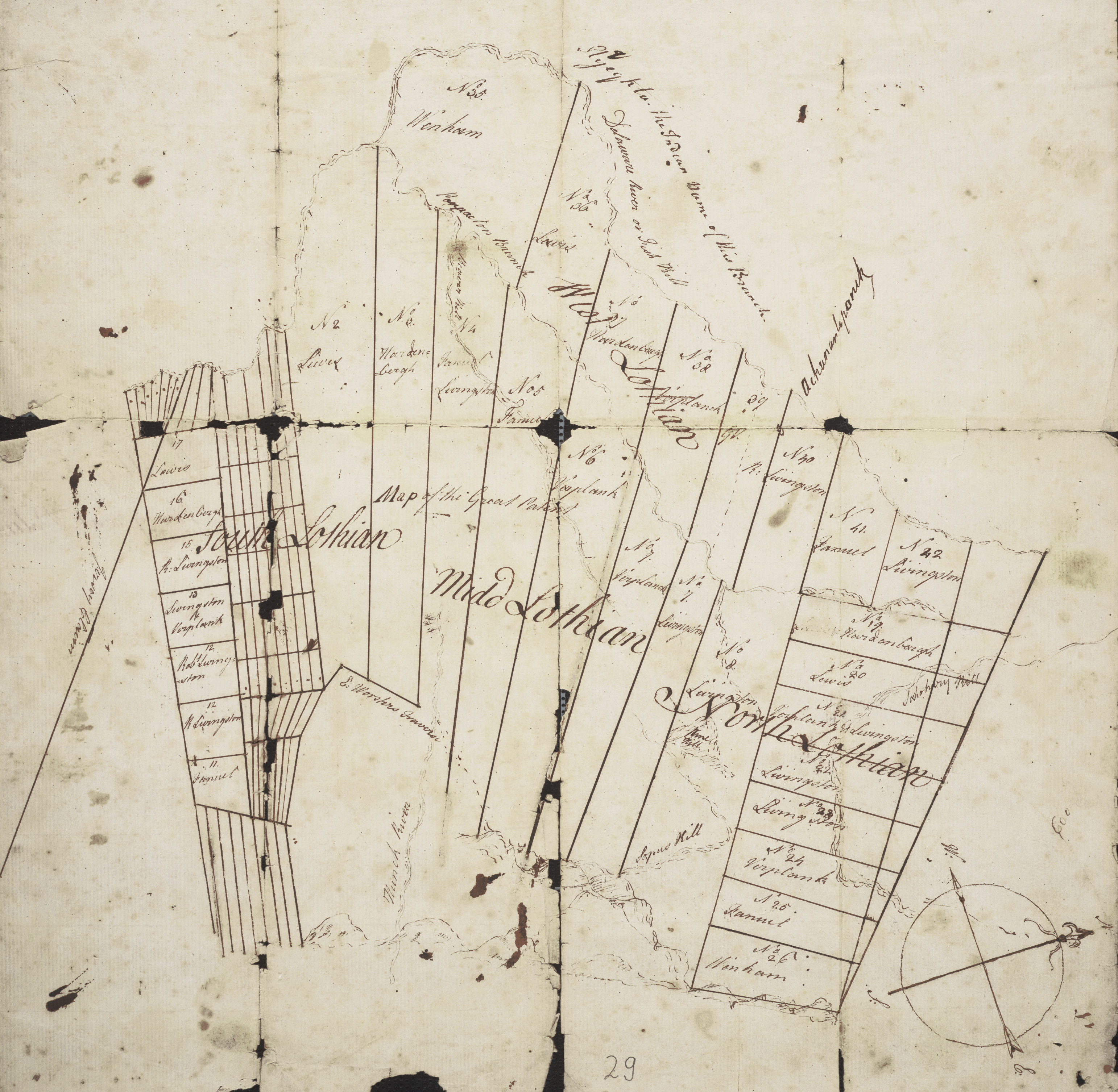
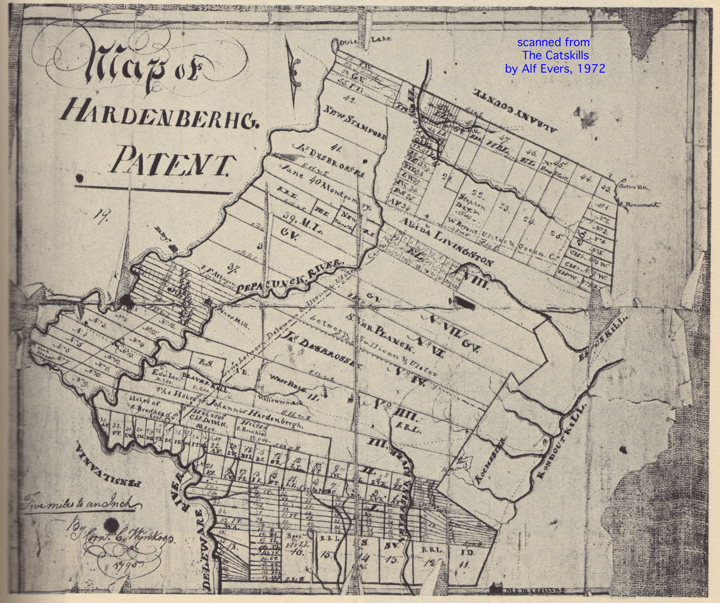 To the right is a map I scanned from
The Catskills: From Wilderness to Woodstock, by Alf Evers. This map of the Hardenbergh Patent was created by surveyor Cornelius C. Wynkoop in 1795.
To the right is a map I scanned from
The Catskills: From Wilderness to Woodstock, by Alf Evers. This map of the Hardenbergh Patent was created by surveyor Cornelius C. Wynkoop in 1795.
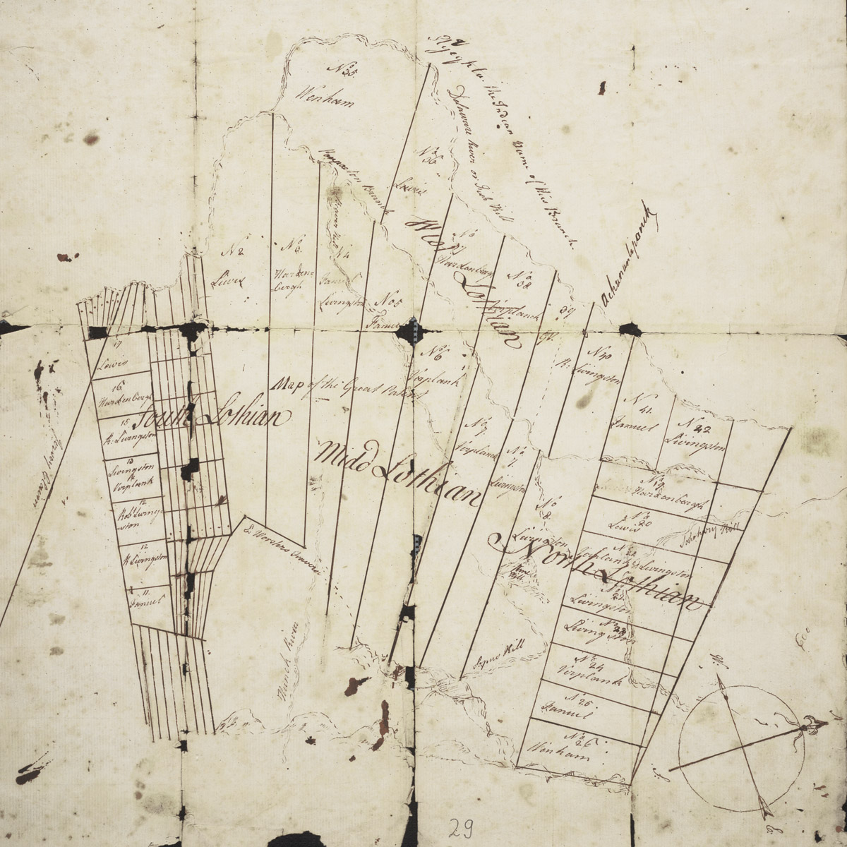 To the left is a map I got from the New York State Library's archive called the Cockburn Family Land Papers.
(hi-res)
To the left is a map I got from the New York State Library's archive called the Cockburn Family Land Papers.
(hi-res)
I was thinking this might be a draft map for map by William Cockburn, but, it appears to be quite a bit earlier. Perhaps is a study for the Wooster map. Does anyone have that map?
It is interesting that it has Lothian on it. Wikipedia's Catskill History says Robert Livingston wanted to rename the Catkills to the Lothian Hills.
created 2013.04.02 <> YON